June 1st Eastern New Mexico and Western Texas Storm Chase - Two Weak Tornadoes
06-01-07 STORM CHASE: NM/TX
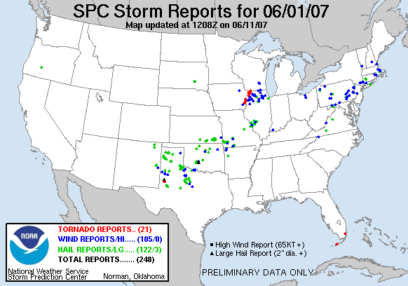
I chased this day with Karen Miller, Beau Gjerdingen, Eric Whitehill, Peggy Willenberg and Melanie Metz as we were out filming for the reality television show, "Twister Sisters". We started the day exploring Palo Duro Canyon State Park just outside of Amarillo, TX. Here we goofed off and did some filming until the mid afternoon before storms started to fire in the western TX Panhandle. Our group disbanded and our car consisting of Karen Miller, myself and our cameraman progressed west on on I-40. Upon reaching Vega, TX we went north on Highway 385 towards Channing, TX. Realizing our storm was not developing as well as we liked, we decided to turn around and head back on Highway 385, crossing I-40, and attempting to intercept another cell near Hereford, TX. Another cell developed in eastern NM that looked like the storm of the day so be abandoned the cell near Hereford and progressed southwest on Highway 60 towards Clovis, NM. The cell was now rapidly developing into a slow-moving and intense supercell just to the west of Portales, NM where we soon intercepted and watched very strong rear flank downdraft (RFD) kicking up a lot of dirt, dust and debris. We did see a lowering embedded the storm where the meso appeared to be located on radar and started to get excited at our prospects at this point. Upon reaching the intersection of highways 480 and 70 just southwest of Portales, the RFD kicked in fierce and our view of the action area became blinded by blowing dirt and debris. At this point, we were very close to the action area and looked up to view a funnel directly in front of us possibly touching down about 100 yards in front of us. That is where I took the photos below of the dirt wrapped funnel. This feature crossed the road in front of us and soon dissipated, although the RFD continued to kick up a lot of dust and dirt to the southeast of Portales. A vehicle of two gentleman came up to us immediately after and asked us if we had just seen that tornado that was close to us. Obviously we did and were fortunate to not have driven any further in front of the possible tornado at this point and had stayed parallel to the action area as it had progressed just south of Portales.
Soon the chase was back on as we continued to follow the storm on Highway 88 southeast of Portales, following the supercell that was picking up speed at this point and exhibiting strong signs of rotation. We chased this cell southeast and ended up on Highway 214 to the north of Morton, TX where we witnessed our second brief and weak touchdown of the day. I actually did not realize that this tornado had touched down until reviewing the photos that night. There was so much dirt and debris being blown around that it was hard to tell in person, not to mention that the sun was setting at this point. Below is the photo from the second tornado that touched down this day. Not very photogenic tornadoes but there was enough evidence that they did touch down. After abandoning the chase, we drove all the way back to Amarillo, TX for the night.
Our chase vehicle (with hail cam strapped to the top) on a cell ~8 miles west-southwest of Portales, NM.
Tornado that touched down around 100 yards in front of us, 4 miles southwest of Portales, NM.
Another view of the tornado with RFD kicking up dirt, 4 miles southwest of Portales, NM.
Mesocyclone with blue, hallow interior and double rainbow. Notice the RFD kicking up dirt directly head of us on the road.
Underneath the supercell and looking at another intense supercell in the distance.
Tornado cutting in from the left and kicking up dirt north of Morton, TX.
Zoomed out view of the tornado kicking up dirt to the north of Morton, TX.
View of the supercell anvil at sunset near Levelland, TX.
More photos from this day can be found here: http://www.flickr.com/photos/39991047@N02/sets/72157621672525853/


