June 21st Southeast Minnesota Storm Chase - Shelf Cloud
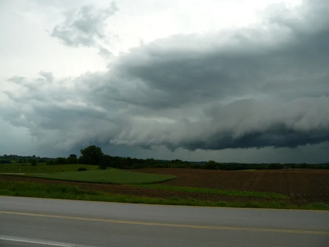
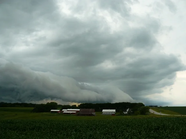
06-21-07 STORM CHASE: MN This was a Slight Risk day in southern MN with a low threat for tornadoes but decent potential for supercells to produce damaging winds and large hail. I was targeting southeast MN near the MN/IA border and that is exactly where we ended up. Our group of myself, MaryLynn Voth, Michael Nardozzi and Ron Borquin left Burnsville, MN at 3pm and headed south on Highway 52 towards Rochester. Two storms fired in this area as we approached and we decided to get on the northernmost cell that was moving from the north to the east side of Rochester. We progressed east on Highway 14 and then north on Highway 42 to the intersection of Highway 9 where we watched the storm approach. At this point it was still developing and not supercellular, but the storm did intensify upon moving south of I-90 as we followed. Near Chatfield, we watched several brief lowerings as the two storms began to merge. Our route took us on Highway 52 and then back north on Highway 74 back to I-90, all the while becoming cored by the merging storms with a lot of heavy rain and some small hail. All of the pictures below were shortly after 5:30pm near St Charles. This is where the merging storms began to become outflow dominant and produce a shelf cloud. The shelf quickly moved overhead while we observed and we let ourselves become cored by the storm. Thereafter, the storms became rather messy and it was not worth staying with them as they were racing east with a lot of rain and nothing all that impressive to continue the chase. At that time, another storm was starting to look impressive and became severe warned to the south of Mankato. We raced west on I-90 and intercepted the storm near Blue Earth as the storm was weakening greatly. Here we got a few nice shots of the storm before it completely fizzled out.
Shelf cloud just starting to form on a storm approaching our location near St Charles, MN.
Another view of the shelf cloud approaching our location near St Charles, MN.
View of the western part of the shelf cloud approaching us near St Charles, MN.
Shelf cloud about to overtake us near St Charles, MN.
Silver lining on a storm as it was fizzling out near Blue Earth, MN.
Sunlight peeking through the clouds around the dying storm near Blue Earth, MN.
More photos from this day can be found here: http://www.flickr.com/photos/39991047@N02/sets/72157621681673765/


