May 23rd Western Oklahoma Storm Chase - Homestead Tornado
One of the many funnels that were spotted shortly after initiation. This was near Isabella, OK.
Actually have two funnels here at the same time, one in the background and the other in the foreground near Isabella, OK.
Funnel halfway to the ground near Homestead, OK. Start of the tornado.
Beautiful tornado touching down near Homestead, OK.
Tornado starting to rope out with debris cloud still present at ground level.
Another storm blowing up to our southwest.
Low precipitation (LP) storm completely tipped over along the dryline near Watonga, OK.
Awesome looking LP storm with sharp updraft along the dryline near Watonga, OK.
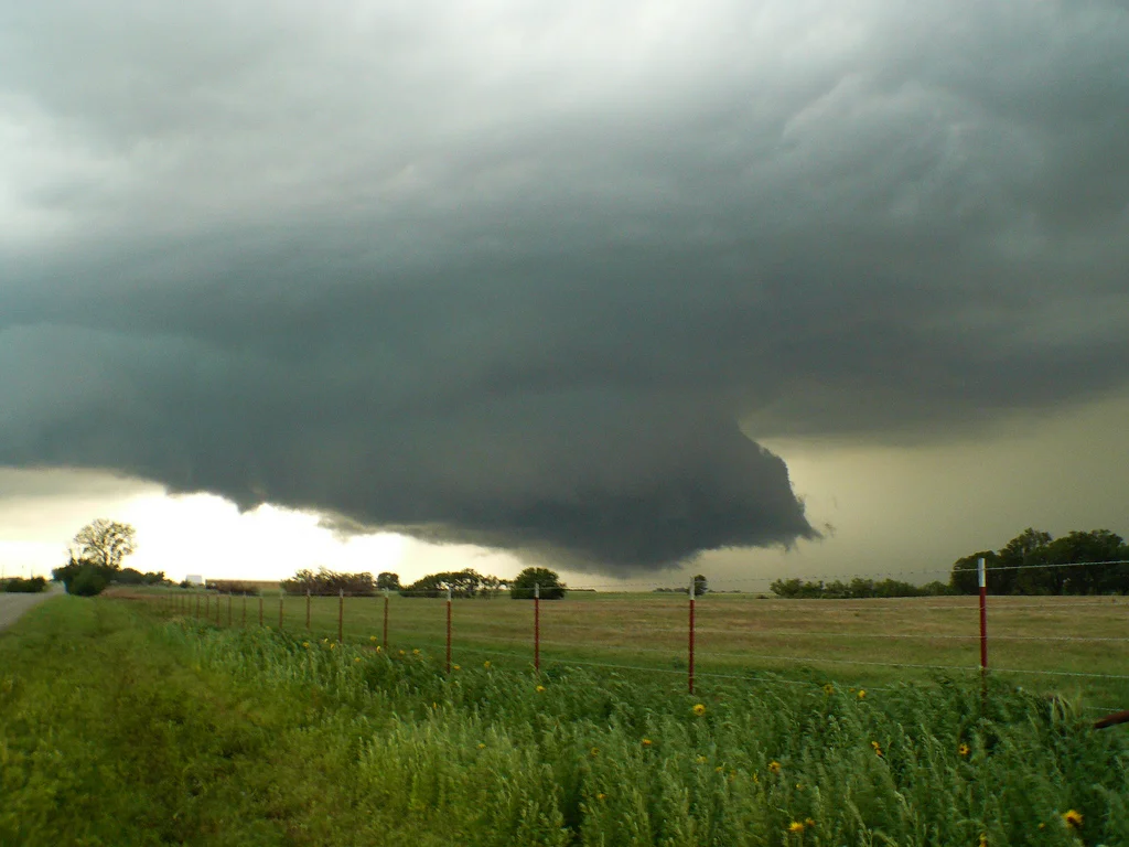
Low, rotating wall cloud near Kingfisher, OK.
Another view of the wall cloud that almost produced a tornado near Kingfisher, OK.
Heard a few other chasers that also thought this was a funnel cloud near or right over Kingfisher as the action area became rain-wrapped.
More photos from this day can be found here: http://www.flickr.com/photos/39991047@N02/sets/72157626821241478/
Storm Reports:
05-23-11 CHASE LOG: OKLAHOMA This was a Moderate Risk for severe weather and a 10% risk for tornadoes through much of western and northern OK and far southeastern KS. The set-up included a weak shortwave trough ejecting out of the Rockies into west TX during the morning and reaching our target area of northwest OK by the afternoon. There was a warm front set up across northern OK that was enhanced by an outflow boundary from a morning MCS that moved through the area. A dryline was forecast to progress into western OK during the afternoon with discrete supercells breaking out along this boundary by mid afternoon in an environment characterized by upper 60’s to lower 70’s dewpoints and 4000-5000 J/KG, moderate wind shear, and a weak cap.
We left Olathe, KS early in the morning and targeted the vicinity of northwest OK for the afternoon. We stopped near Tonkawa, OK for lunch and also to re-evaluate as I did not want to underestimate the outflow boundary/warm front and storms developing along this boundary across north-central and northeast OK as they would surely have tornado potential. The decision was made to head west near the dryline as storms developed between 2-3pm in far southwest and west-central OK. Our course was to take Hwy 64/412 west towards Enid and then west of that area towards the Ringwood area where we watched storms develop on the dryline. The storm that caught our attention was further southwest and was clearly the dominant storm on the dryline at the time, so we progressed south on Hwy 8. As we were looking west, just to the north of Okeene near 3:36pm, the storm produced a tornado near the Longdale/Homestead areas that was rather short lived but absolutely beautiful with how high the LCL’s were. This was a rope tornado that did not produce any damage from what we could tell. We followed this storm to the east, and even dropped south on another storm, before moving back north to near Kingfisher where we witnessed a rotation wall cloud just to the north of town. At this point, it was very close to producing a tornado, but could not completely get its act together and died out before producing. Shortly after, the storm turned into a mess as we followed east and became very high precipitation (HP). We ended up heading back to Enid for the night to prepare for the next day’s chase.


