MAY 23RD COLORADO: SUPERCELLS, TIME LAPSE, & GUSTNADOES
First storm of the day with intense core near Ordway, Colorado.
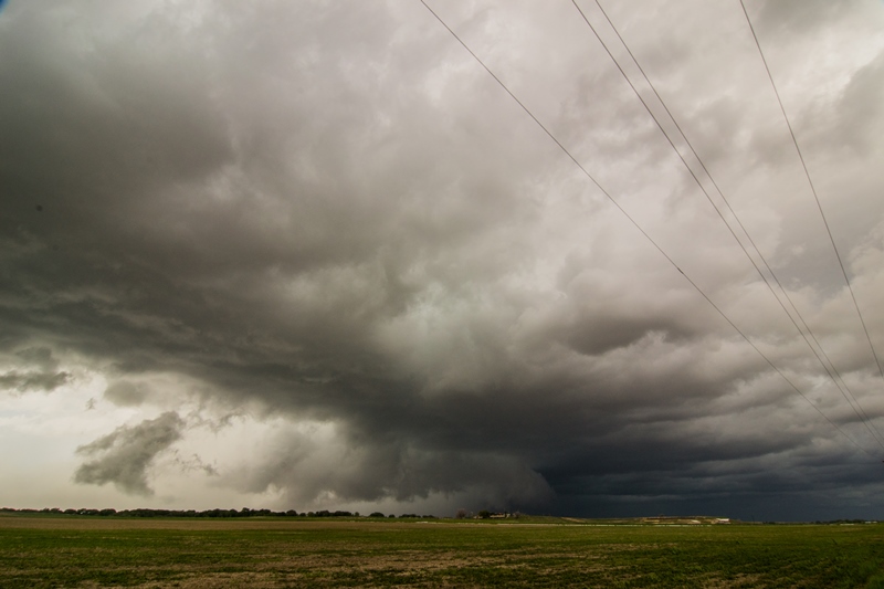
Storm taking on supercell characteristics at this point, near Cheraw, CO. Terrific structure with large, lowered base underneath the updraft.
Tail cloud feeding into the storm base as the storm tries to form a wall cloud.
Gustnadoes forming underneath the action area of the hook wrapping around the southern part of the storm near La Junta, CO.
A closer look at some of the dirt being kicked up by possible gustnadoes and RFD winds near La Junta, CO.
Storm starting to form a shelf cloud and become outflow dominant near Las Animas, CO. But there is still some inflow left directly to the northwest where a notch is present in the storm. Very noticeable hook on radar at this point.
A short while later as the shelf cloud was becoming more prominent and approaching our location. To the north, a funnel was reported in the notch to the south of Arlington, CO. Could not see it from this vantage point.
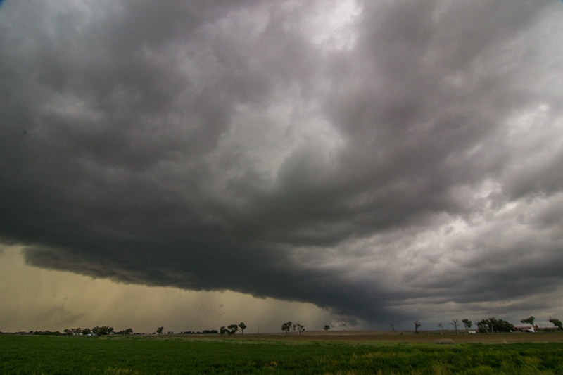
Shelf cloud approaching! Looking south from near Lamar, Colorado.
Northern view with shelf cloud approaching and intense storm core full of hail and very heavy rain.
STORM REPORTS:
SPC OUTLOOKS:
MAY 23, 2015 CHASE LOG: COLORADO
Written by Rich Hamel: (www.bostonstormchaser.com/)
Day 5:
Another day with multiple targets, though at least this time we were within easy striking distance of both. The models broke out storms near Denver and intensified them significantly as the “Denver Cyclone” brewed up, and also down near Pueblo, moving off the mountains and out onto the eastern Colorado plains. Since we were in Limon, we were able to sleep in a little and sat for a while, waiting for the storms to brew up. By Noon, both areas had initiation, but the storms down south looked better on radar, and were in a much better environment than the cold air up north, so we decided to target the storms to the south. We headed out of Limon straight south on Rt. 71 through Punkin Center, closing on the storms quickly as they were moving almost straight north to meet us. Though the target storm was masked by some small cores out in front of it, we could see the bases of several other storms in the area along a broad line of storms running north-south all along the mountains. You can see a LONG way out there.
As we closed on Ordway, we were facing 3 separate storms that were pulsing up and down, each alternately looking better than the others. We decided to get east in order to stay ahead of the line, and proceeded east on Rt. 96 through Sugar City. As we headed east, the base of the southernmost storm, which was our target, came into view with a big blocky wall cloud almost on the ground! Once we cleared the precipitation core, we headed south on Rt. 31 towards Cheraw. We stopped and watched as the first lowering passed by to our east, and a new cell came up from the south with another lowering as the line kept expanding to the south. There were a few times that areas along the line tried to tighten up but none ever did. Later, as we headed south, then east out of Cheraw on County Road HH, a funnel appeared under the southernmost cell in the line, and made it about three-quarters of the way to the ground before dissipating. We headed east until we intersected Rt. 194, stopping occasionally to watch the roiling motion along the line, where different segments of the line kept bubbling up and down in intensity but none over really took off.
Realizing that we were running out of roads to get north as the storms moved off to our northeast, we blasted east to Wiley, but by then the line was dying and another segment of storms was coming up from the south, so we stopped at the truck stop north of Lamar and waited for them to approach. We ended up waiting for nearly an hour as the line segments slowly closed in on our position, but they appeared to be weakening and we were about ready to call it a day when there was a report of a wall cloud on the line segment passing just to our west, so we zoomed west and intercepted the line again. There was some pretty strong rotation at points, but not enough to tornado, and as the shelf cloud got to us it was time to head east.
We stayed out in front of the line, stopping every now and then to let the squall line catch us, passing north of Lamar in Rt. 196 until we were forced to turn around as a semi had somehow gotten its front wheels stuck in the mud on the north side, and was broadside across the entire road with the rear wheels stuck in the mud on the south side. We headed back west about 5 miles then flew south, just barely touching the core before heading east on Rt. 50.
We continued along Rt. 50 to Holly and stopped again waiting for the new tail end storm to come up from the southwest, but it weakened as it approached and soon we decided to call it a day and headed to our hotel in Garden City, KS. A fun chase day but there never appeared to be enough instability to get the cells to severe parameters, nor was there enough shear to break the storms into discrete cells.
Total miles for the day were not bad: 295


