APRIL 15, 2012 MINNESOTA STORM CHASE - STORM THROUGH TWIN CITIES METRO
04-15-2012 CHASE LOG: MINNESOTA This was supposed to be the big “day after the outbreak” severe weather event across the Upper Midwest, which ended up being a lot less severe than what most were thinking. The set-up included an area of low pressure near the Sioux Falls, SD area around midday that was traveling along a warm front that was lifting into south-central MN. There was also a mixed out dryline/cold front that was moving to the east through southern MN and IA through the afternoon. The environment ahead of this system and south of the warm front was characterized by temperatures in the 70s, dewpoints in the upper 50s and 60s, upwards of 1000-1500 j/kg of MLCAPE, and 50-70 knots of effective bulk shear.
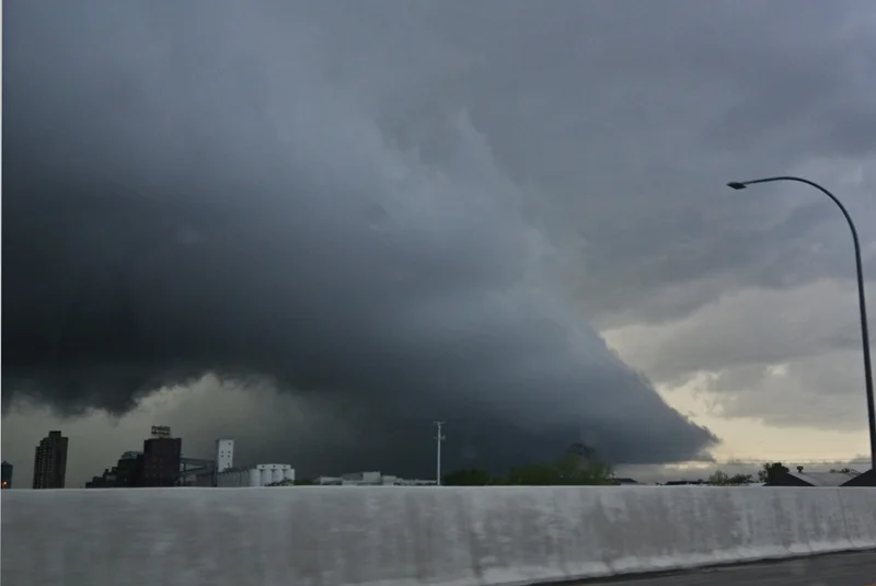
I had plans for much of the afternoon and was not sure if I would be able to chase or not, but the storms held off until the late afternoon to reach the Twin Cities area so I was able to head out. I didn’t think we needed to go very far since the Twin Cities is where I thought there would be the best chance to see a storm produce a tornado due to the warm front lying right across the metro area with better backed surface winds. A tornado watch was issued for the area at 3:40pm highlighting the tornado risk due to the unstable environment, intense vertical wind shear, and the very strong winds aloft. A few storms in the vicinity of 5pm became tornado warned around 30-40 miles west of the Twin Cities and produced a couple of weak tornadoes right on the triple point, which we did not see. MaryLynn, Sheena McLain, and I traveled south on I-35 out of Burnsville to intercept a couple storms that were moving up towards the area from the south. We got on the first storm near New Prague and then followed it up highways 21, 169, and 41 through Chaska towards the southwest side of the Twin Cities metro. At this time (5:54pm), the Storm Prediction Center issued a mesoscale discussion highlighting the increased tornado risk near the Twin Cities. The storm became better organized as it approached the warm front and developed a non-rotating wall cloud as we followed parallel to the storm on I-494 and then east on I-394 to get back out ahead. The storm interacted with the warm front right near downtown Minneapolis and this is where the storm looked the best with a better defined non-rotating wall cloud and more rapid condensation into it at that time. The inflow tail was very low and appeared to only be a few hundred feet off the ground at this time as it moved into northeast Minneapolis. There may be some that were questioning if this was indeed a wall cloud over downtown or just a shelf cloud at that time. I would argue for a wall cloud that transitioned into a shelf as the storm became more outflow dominant upon moving further north and east. The reason I’d argue for a wall cloud is, quite simply, because it looked like one and had fairly fast condensating air into it at the time it was interacting with the warm front (see pictures below). After the storm moves into the eastern part of the metro area, it gusted out and produced a ragged shelf cloud towards sunset.
Lowered base on the storm looking southwest near the highway 212/I-494 interchange in Eden Praire, MN.
Storm over downtown Minneapolis. This was the non-rotating wall cloud with fairly quick condensation into it at this time.
Another view of the non-rotating wall cloud and condensating inflow scraping the ground near downtown Minneapolis.
Storm starting to transition to more outflow dominant near Arden Hills, but with continued inflow tail into it.
Shelf cloud in North St Paul towards sunset.
More photos from this day can be found here: http://www.flickr.com/photos/39991047@N02/sets/72157629473913578/


