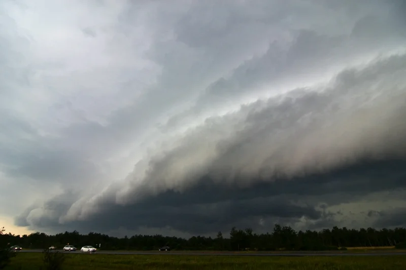
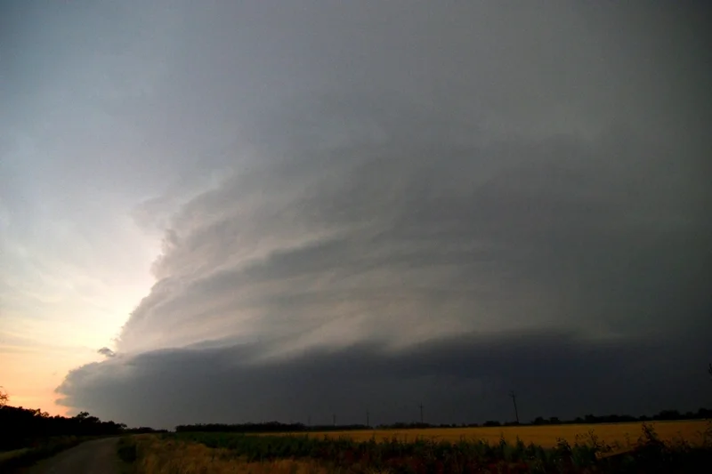
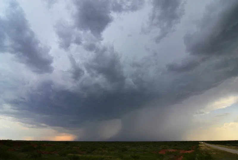
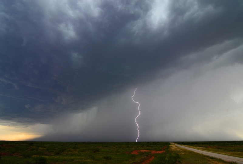
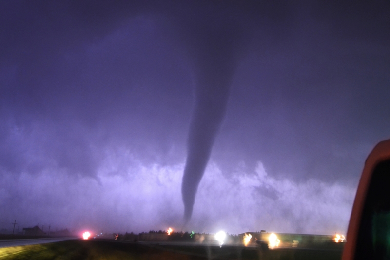
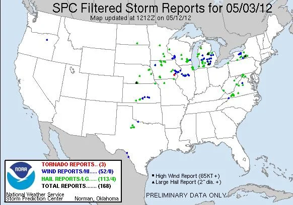
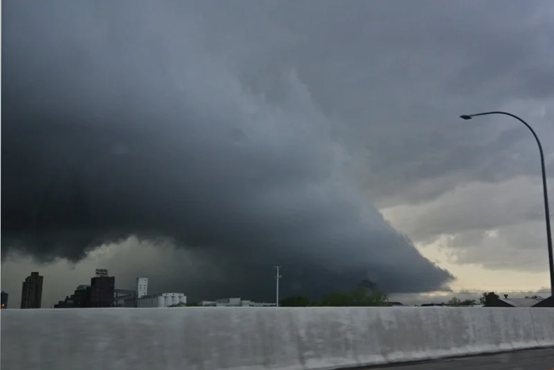
JULY 6TH, 2012 MINNESOTA - WALL CLOUD ON SEVERE STORM

07-06-2012:  MINNESOTA  This day featured a Slight Risk, stretching from eastern SD through central MN into northern WI.  There was a 5% tornado risk along a stalled front through central MN, roughly from Benson to North Branch, MN.  The setup included this front that actually sagged south to near the Hwy 12 corridor by the afternoon and then southwest towards Marshall to a surface low across southeast SD by the afternoon.  In the upper levels, there was generally weak support over central/southern MN as the higher bulk shear and jet level winds were displaced well to the north of the boundary across northern MN into Ontario.  A weak shortwave was expected to give a glancing blow to the area along the front and ignite severe thunderstorms across the area by mid to late afternoon.

I left work at 2:30pm and met Wes Hyduke at my place and we chose to head northwest towards the Dassel area to target initiation.  As we headed west towards Dassel, we noticed a CU field growing directly ahead of us where two boundaries appeared to be coming together.  Between 3:45 and 4:45pm, this CU field grew in size and became better defined as the boundary began to move southeast towards the Twin Cities.  We progressed southeast through Winsted and New Germany, following what was becoming towering CU in an environment characterized by 3000-4000 j/kg of MLCAPE and rich boundary layer moisture of low 70s dewpoints.  Storms were having a difficult time getting going due to the capped air of 21-24C 850 temps and 12-14C 700 mb temps.  However, one storm broke through around 6pm near Fairfax, right as a mesoscale discussion was issued that highlighted the risk for severe thunderstorms with damaging winds and large hail in central MN.  Between 6-7pm, additional storms fired on the boundary over the Twin Cities and northeast, while we chose to target the southwest storm approaching New Auburn.  We ended up traveling south on Cty Rd 33/5 to near the Assumption State Wildlife Management Area where we intercepted the storm.  At 6:40pm, a Severe Thunderstorm Watch was issued for areas from south-central MN through the Twin Cities and into northwest WI.

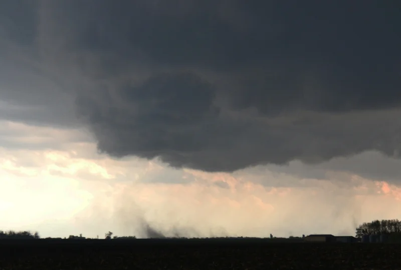
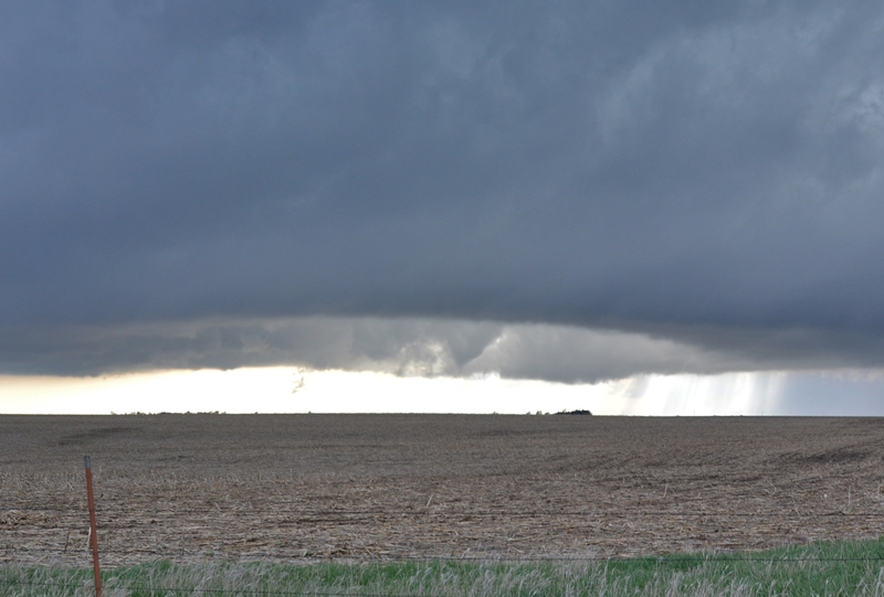
The storm became better organized northeast of Green Isle and was one of the few storms that did not yet get undercut by the southeast moving front.  All storms north of the boundary that were not rooted were quickly weakening and dying, but our storm was still locked on the boundary.  In the vicinity of 7:15-7:30pm, the storm did produce a slowly rotating wall cloud and what looked to be a brief funnel as the boundary came through and quickly undercut the storm.  It was surprising that it did this much because the surface winds were very weak and sometimes non-existent, but the storm seemed to have some sort of lower mid-level inflow as noted by the condensating inflow tail.  The wall cloud did not last long and the storm had pretty good structure for only a short while before completely dying upon moving north of the boundary.

DSC_0333-2
DSC_0333-2

A pair of severe warned storms along the front to our northeast, over the Twin Cities metro.

DSC_0339-2
DSC_0339-2

Lowering on a storm to our northwest near Hamburg, MN.

DSC_0351-2
DSC_0351-2

Beautiful storm with wall cloud underneath and inflow tail cloud into it.  New updraft on the southwest flank.

DSC_0354-2
DSC_0354-2

Closer view of the wall cloud and inflow tail with rain core on the north side.

DSC_0359-2
DSC_0359-2

Towards the tail end of where I think there may have been a short-lived funnel on the left side of the wall cloud.  This feature is shown better in the video.

DSC_0365-2
DSC_0365-2

Watching the backlit storm as it began meeting its demise east of Green Isle, MN.

STORM REPORTS:

120706_rpts_filtered

STORM PREDICTION CENTER OUTLOOKS:

7-6-12 Outlook
7-6-12 Outlook

JUNE 14TH, 2012 MINNESOTA - SEVERE STORMS & SHELF CLOUDS

06-14-2012:  MINNESOTA This was a tricky day but, initially, with a lot of promise.  SPC had outlined a Slight Risk through much of MN with a 10% tornado risk from roughly Faribault through the Twin Cities and north to Hinckley.  A complex of storms had rolled through the Twin Cities during the morning hours, producing a magnificent shelf cloud that I was able to view and take pictures of from my home in Burnsville.  After the shelf went through, Jeff Buck and I went south on I-35 to get out ahead of the storm.  We progressed to Faribault as the gust front and outflow boundary began to stall and the shelf fell apart right in front of our eyes, so we turned around and headed back home.  The thinking was that this outflow boundary would lift back north to the Twin Cities during the afternoon and we would be in good position at my house.

There was a surface low developing in far northeast SD with a cold front draped south of there.  The western part of the outflow boundary/warm front began to lift back north during the afternoon with the low, but persistent convection along the rest of the boundary allowed it to remain stalled through roughly Mankato over to just north of Rochester.  This convection ended up being the caveat that limited the overall severe weather risk and essentially shut down any chance for tornadoes.  We left my place and progressed down Hwy 169 and west on Hwy 19 to near Gaylord where we stopped to re-evaluate.  A mesoscale discussion was issued by the SPC at 1:44pm for areas along and ahead of the surface low/cold front and near the western portion of the outflow boundary where the environment had become moderately unstable with 1500-2000 j/kg of MLCAPE and bulk shear of 40-55 kts.  At 2:45pm, a severe thunderstorm watch was issued for counties right near and north of the outflow boundary, where storms were ongoing but becoming stronger as the instability increased and temperatures cooled aloft into the afternoon hours.

The first storm we intercepted was just south of Gaylord on Hwy 22.  This storm initially looked pretty good with an inflow tail and intense rain/hail core with echo tops over 40,000 ft.  But this cell could never really get going and we ended up bailing and chasing after stronger storms to the east on Cty Hwy 8, then south on Hwy 112 out of Le Sueur and east on Hwy 99.  These storms appeared to be going into a worse environment, but continued to strengthen after we stayed put northwest of Faribault.  The storms looked really strong, almost supercell-like, on radar as they progressed over Hwy 52 and towards the MS River.  These storms dropped considerable amounts of rainfall through the day that led to widespread flooding through this entire area as well as some hail and wind damage.

After waiting around for 20 min, a new cell began to form and we went back west, viewing a shelf cloud moving over Mazaska Lake (picture below), and even an attempt at a base on a storm near the Hwy 99/Cty Rd 137 intersection.  The storm that produced the base eventually puked out so we went back west to intercept another storm near Hwy 169 in St Peter.  After taking a pit stop at the local dairy queen, we made a feeble attempt to chase back east on Hwy 99 all the way to I-35 to see if we could muster up anything else, but nothing all that interesting developing along the way so we headed back home.  Overall, I think the clouds and persistent convection really kept things in check and weaker than anticipated on this day, and dewpoints never really got as high as forecast once again.  I’m sure there were more reasons, but these were the glaring issues.

DSC_0277-2
DSC_0277-2

Awesome shelf cloud moving over my house in Burnsville, MN around 9am.

DSC_0279-2
DSC_0279-2

Shelf cloud from across the street in the Byerly's parking lot.

DSC_0284-2
DSC_0284-2

Strong core underneath developing storm southwest of Gaylord, MN.

DSC_0296-2
DSC_0296-2

Shelf cloud moving across Mazaska Lake northwest of Faribault, MN.

DSC_0300-2
DSC_0300-2

A weak attempt at a lowering, the only one of the day, southeast of Montgomery, MN on Hwy 99.

DSC_0306-2
DSC_0306-2

Tried to punch this core heading north towards Montgomery, but it only had dime size at most when we went through.

DSC_0315-2
DSC_0315-2

Rather intense shelf cloud with rapid rising motion on the forward flank near Le Center, MN.

STORM REPORTS:

120614_rpts_filtered

SPC OUTLOOK:

day1otlk_20120614_1630_prt

SPC TORNADO OUTLOOK (1630z):

day1probotlk_20120614_1630_torn_prt

JUNE 10TH, 2012 MINNESOTA - SHELF CLOUDS GALORE

06-10-2012:  MINNESOTA A short chase log here as this was not a significant severe weather day, but did have some photogenic opportunities.  I had to work this morning and took off right after work to chase with MaryLynn across central MN.  There was a slight risk for most of MN with a 5% tornado risk.  This was a cold front setup for the area, which usually means one thing for storm mode…linear storms with wind damage and shelf clouds.  That is exactly what we got as we progressed northwest on Hwy 10 and then north on Hwy 25 through Foley and north from there to get out ahead of initially more isolated storms developing well out ahead of the cold front and more linear storms further west.  These storms were developing in a marginally unstable environment with dewpoints only in the lower 60s, so they had a tough time getting going and even holding together.  We decided to let those storms go to the north and chase west on 153rd St and Hwy 27 through Pierz to intercept the severe warned line of storms approaching Little Falls.  After getting through Little Falls and south on Hwy 10, that is where we saw our first shelf cloud of the day as the line moved in.  We were able to stay just ahead of the storms as we moved southeast on Hwy 10, due to the orientation of the line, while we attempted to intercept the most intense part of the storm southwest of Royalton on the Great River Road.  At this point, we were slammed by some estimated 40 mph winds, small hail, and intense rainfall rates.  There must have been higher winds to the south, as we encountered a bunch of trees down on the road as we approached Sartell from the north on Hwy 1.  We were able to get around the trees and get back through Sartell on Hwy 10 and eventually back onto I-94 to get ahead of the line once again.  We stopped in Monticello just off the exit to take more pictures of the shelf cloud and then traveled back home for the night to Burnsville, where we ended up getting hit by another intense storm right at sunset.  This storm apparently produced a tornado near Belle Plaine at 8:15pm, but was embedded in the storm when it looked like it was producing straight line winds.

DSC_0240-2
DSC_0240-2

Shelf cloud approaching us near Little Falls, MN.

DSC_0244-2
DSC_0244-2

Well structured shelf cloud getting closer south of Little Falls, MN.

DSC_0248-2
DSC_0248-2

Another shot of the cool looking shelf.

DSC_0252-2
DSC_0252-2

Looking to the north as the shelf was moving over.

DSC_0257-2
DSC_0257-2

Interesting feature here near Royalton, MN.  This looked like a storm base with a notch in the line, shear markers on GR3, and some rotation shown on the velocity imagery at the time.  It rocketed by us to the north fairly quickly and looked to gust out a short time later.

DSC_0262-2
DSC_0262-2

Tail cloud on the storm base as we crossed the MS River near Royalton, looking north.

DSC_0265-2
DSC_0265-2

Shelf cloud approaching Monticello, MN.

DSC_0266-2
DSC_0266-2

Shelf cloud about to overtake us in Monticello, MN.

STORM REPORTS:

120610_rpts_filtered

SPC OUTLOOK:

day1otlk_20120610_1630_prt

MAY 30TH, 2012 TEXAS - MASSIVE HIGH PRECIPITATION SUPERCELL

05-30-2012 CHASE LOG:  TEXAS This ended up being a very good day with some forecasting challenges.  We were presented with a dilemma in the morning, being torn between a target that SPC and many other chasers favored along the warm front in southern KS into northern OK, with the other target along the dryline in the eastern TX Panhandle.  We favored the TX Panhandle target due to the presence of higher instability and with the moisture axis being oriented right over the area, along with a dryline in place.  The better upper level support was to the north, but there was still around 50 kts of deep layer shear and very steep lapse rates in this area.  The concern was that, if rich moisture could reach the warm front, storm motion would be right along the boundary and lead to a tornado threat.  It became apparent as we left Oklahoma City and headed west on I-40 that the moisture was not going to be as high as the models suggested further north.  We officially made up our minds towards early afternoon to head to TX as the short range model guidance was breaking out a pair of supercells in the Panhandle and we thought the better environment was in place.  We headed towards the dryline, east of the Caprock, towards Memphis, TX.

At 2:58pm, a mesoscale discussion was issued by SPC for an area of northwest TX in our target zone.  This discussion highlighted the corridor of strong instability, as noted by the 2500-3500 j/kg of MLCAPE up through the area, with surface dewpoints in the mid 60s, and steep lapse rates near 8.0 C/km.  This also noted the wave clouds that we noticed upon driving to our target area, suggesting the environment would be more stable further to the east.  Shortly after 4pm, supercells exploded on the dryline near and east of the Caprock in the eastern TX Panhandle, while a Tornado Watch was issued for the area at 3:40pm.  We were on our first storm near Memphis, which had a large rain-free updraft initially and a pair of long inflow bands feeding into the storm.  We were able to sit and watch this storm for a half hour before the lightning threat became too great and we were forced to bail south on Hwy 287 towards Childress.  We had to watch a storm to our south that had unimpeded inflow and was in danger of cutting off the inflow into our storm.  However, our storm continued to look good as it produced numerous shear funnels and awesome corkscrew structure with strong inflow sucking in red dirt right into the updraft base.  The inflow had to be around 50 mph INTO the storm at times as we progressed into Estelline and decided to head west around the mesocyclone on Hwy 86.  We watched as this storm neared, but quickly turned back and almost got cut off by huge hail, some that started to fall as we neared Estelline and bailed south again on Hwy 287.  This was where we put a few more cracks in the windshields due to the hard golf ball or larger sized hail that was falling.  We got out ahead of the storm again and watched as it became a skinnier LP storm, but was tornado warned and did have some rotation in the base at times.  A short while later it looked to be weakening, but still had great structure as we stopped by Cee Vee, TX to watch.  The southern storm was taking over and intensifying.

We blasted south towards Paducah to get to the southern storm that was growing to be a massive HP monster with gorilla sized hail.  This storm had significant rotation with 100 kts of shear, and soon became tornado warned as we tried to get ahead.  As we headed down Rt. 83 with the rear flank of the storm's hook echo just about 10 miles to our southeast, we observed significant lightning-induced fires on both side of the road.  Heading into Paducah it was an eerie sight: There was a giant plume of red dirt suspended in the air just east of town, and the town itself had clearly suffered some significant wind damage, with limbs broken off trees, sheet metal roofing blown off buildings, and debris all over the place.  One spotter report suggested 100 mph rear-flank downdraft winds or a potential landspout tornado has caused the damage.  Sure enough, as we exited the town, a long ropey landspout tornado with a red debris fan was visible on the rear flank of the storm and remained for a minute or two before it dissipated.  That was tornado number 5 for the tour!  Having cleared Paducah, we were still cutoff from the inflow notch of the storm and were forced to continue another town south, down to Guthrie.  While we could still not see into the inflow notch of the storm, the mammatus clouds hanging out of the anvil were absolutely spectacular.  As we continued east through Knox City and west of Seymour, we finally got out ahead of the massive supercell where it had terrific structure due to the spiraled, stacked plates look.  I honestly cannot remember seeing such a huge supercell storm in my life.  It was a storm that was dropping hail larger than softballs, had confirmed, rain-wrapped tornadoes buried in it, and high amounts of cg lightning.  Certainly not something we wanted to wait around for and roll over us.  We did observe the storm towards sunset as we traveled towards Seymour and a fantastic lightning display upon driving home for the night towards Oklahoma City, just as the gust front from the KS storms reached the city.

DSC_0146-2
DSC_0146-2

Storm just getting going as it moved off the Caprock and dryline near Memphis, TX.

DSC_0155-3
DSC_0155-3

LP supercell south of Memphis, TX with shear funnel on the right side of the storm near the clear slot.

DSC_0164-2
DSC_0164-2

Very strong inflow at our back and into the storm, sucking in all of the red Texas dirt right into the updraft base.

DSC_0170-2
DSC_0170-2

Storm taking on better structure north of Estelline, TX.

DSC_0172-2
DSC_0172-2

Another view of the updraft curling up into the storm north of Estelline, TX.

DSC_0188-2
DSC_0188-2

Supercell starting to get tipped over with more rain/hail falling out of the eastern end of the updraft.

DSC_0195-2
DSC_0195-2

Massive supercell as we started to get out ahead near Benjamin, TX.

DSC_0206-2
DSC_0206-2

Huge HP supercell nearing us east of Benjamin, TX.

May 30
May 30

Video capture of a lightning bolt out of the supercell between Benjamin and Seymour, TX.

STORM REPORTS:

120530_rpts_filtered

SPC OUTLOOKS:

5-30-12 Outlooks
5-30-12 Outlooks

MAY 29TH, 2012 OKLAHOMA - SUPERCELL STRUCTURE & PIEDMONT TORNADO

05-29-2012:  OKLAHOMA  I never thought that I would have a chase day where I would see a tornado, but this would be overshadowed by the supercell structure itself.  This was certainly one of those days!  Our group of SLT crew and guests started out in Wichita Falls, TX and headed north, targeting an area between Woodward and Enid, OK.  SPC had a Slight Risk out from southern KS through much of OK and into northern TX with a 5% tornado risk (all outlooks below).  The setup by the afternoon included a 1007 mb surface low near Childress, TX with a moisture axis extending northward through western OK where dewpoints were in the upper 60s.  Strong instability developed ahead of surface low with 3,000-4,500 j/kg of MLCAPE building into much of OK.  In the upper levels, there was northwest flow at 500 mb with a weak area of vorticity caught in the flow that would help be the trigger for convection.  0-6 km shear of 35-45 kts with strong directional shear from 1-4 km indicated an environment favorable for supercells and an isolated tornado threat, while steep mid level lapse rates would bring a risk for very large hail.

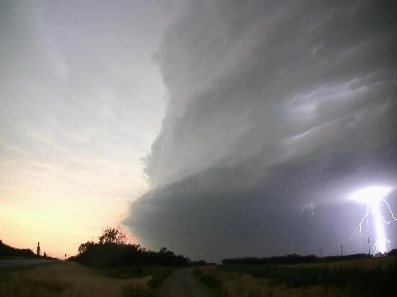
We progressed north to Watonga, OK on Hwy 281, sat for a while to watch the developing cumulus field, and then decided to head further north on Hwy 51A to Fairview.  Along the way, SPC issued a Mesoscale Discussion at 3:06pm for the area and a Severe Thunderstorm Watch at 3:55pm, valid until 11:00pm for most of western OK.  The cumulus quickly turned into towers going up from near the KS border to northwest TX and one developing storm soon caught our eye near Isabella.  This initial storm was struggling at first to get going and remained very LP as we got closer to Okeene, but took on incredible structure as the storm base and updraft were twisting like a corkscrew and took on a barber pole look.  At this point near Okeene, we continued to remain on the southeast part of the storm, which allowed for great structure shots, but the storm started firing cg’s like crazy and we were forced into the vans.  The lightning even caused numerous fires in the dry wheat fields in the area!  Upon reaching a point near Hennessey, the storm began taking on more classic supercell characteristics and was spinning like a top, while a rotating wall cloud formed under the base.  I thought for sure that this storm would drop a tornado here, but it never could get its balance down right.

We drove towards Kingfisher on Hwy 81 and waited on a hill on the south part of town as the supercell began taking on more of an HP look and barreled towards the town.  The supercell had several mesocyclones and a few wall clouds as it moved near and over Kingfisher…kind of a scary moment where it looked like it might drop one on the town.  We were in danger of being cut off from this storm as we continued south to Okarche and then east towards Piedmont, stopping a few times along the way to take pictures of the amazing storm structure.  The storm took on striations with a tentacle look to the inflow bands as they wrapped completely around the storm’s mesocyclone, while a bowl shaped lowering formed as we stopped and watched near Piedmont.  This was the third time in the day that I thought I may have seen the best supercell structure in my life!  As a left-moving storm came up from the south, the gust front interacted with our storm and this was enough to produce a tornado at 8:28pm, which lasted for a few minutes.  The tornado itself was kind of hard to see due to being rain-wrapped, but it was certainly there and reported by several other chasers.  Right after producing the tornado, the storm really began to gust out and become a squall line as several storms congealed.  We raced to the south out ahead and west on I-40 towards El Reno and south on Hwy 81.  Near the Canadian River we saw a huge dust plume that looked to be RFD or strong outflow kicking around/ahead of the west side of the developing squall line, and this was (falsely) reported as a tornado at that time.  However, it did look interesting between the lightning flashes as it was becoming dark and even we questioned if it could be a tornado for a brief moment.  After getting ahead of the squall line and seeing the shelf cloud, we punched back north through the rain, wind, and small hail to get back to our hotel in Oklahoma City for the night.  It was interesting when we got back, as this area had been pounded by high winds and baseball sized hail with the storms we were chasing all day.  There was quite a bit of noticeable damage to vehicles, signs, and trees as a result, as well as some good stories from the hotel staff and guest.
DSC_0039-2
DSC_0039-2

Cumulus above grain elevator in Watonga, OK.

DSC_0053-2
DSC_0053-2

Twisting and intense updraft with low precipitation supercell near Okeene, OK.

DSC_0057-2
DSC_0057-2

Shear funnel on supercell near Okeene, OK.

DSC_0060-2
DSC_0060-2

Low precipitation supercell becoming more intense with larger base between Okeene and Hennessey, OK.

DSC_0074-2
DSC_0074-2

Storm becoming even better structured with striations and intense updraft near Hennessey, OK.  Possibly a funnel on the right side of the base?

DSC_0078-2
DSC_0078-2

Incredibly structured, striated and intense supercell near Hennessey, OK.  One of the best I have ever seen!

DSC_0084-2
DSC_0084-2

Supercell getting more of that "wall cloud" look under the base.

DSC_0086-2
DSC_0086-2

Almost produced a tornado at this point.  Rapid condensation and some rotation with this lowering as it was coming right at us.

DSC_0087-2
DSC_0087-2

In front of the storm as it was close to producing.

DSC_0098-2
DSC_0098-2

More of a classic supercell with lots of rotation and motion in this base over Kingfisher, OK.

DSC_0112-2
DSC_0112-2

One of the best supercells that I have ever seen!  This was near Piedmont, OK shortly before producing the tornado.  Notice the inflow "tentacle" wrapping around the base of the storm, intense rain/hail core, and lowered bowl in the middle, indicating a tornado is close to forming.

DSC_0115-2
DSC_0115-2

Another view of the amazing supercell a short while later as the inflow band was wrapping around.  Still have that bowl lowering underneath.

DSC_0117-2
DSC_0117-2

Left edge of supercell showing the thick, stacked plates look.

DSC_0129-2
DSC_0129-2

Rain wrapped tornado near Piedmont, OK.  If you look close, you can see the debris fan.

DSC_0129-3
DSC_0129-3

Closer view of the tornado from the previous photo.

DSC_0130-2
DSC_0130-2

Rain wrapped tornado in the middle as it was close to lifting near Piedmont, OK.

Storm Reports:

120529_rpts_filtered

SPC Outlooks:

5-29 Outlooks
5-29 Outlooks

MAY 28TH, 2012 TEXAS - TEXAS SIZE STORMS

05-28-12:  TEXAS We started the day in Salina, KS and progressed towards northwest TX where SPC had a Slight Risk for severe weather in place with a 30% hatched area for significant hail.  With dewpoints in the lower 60s, better upper level forcing well to the north, and fairly weak southeast surface winds, we figured that storms would be fairly high based and that this was going to be mainly a structure type of day with damaging winds and big hail the main severe threats.  As mentioned, higher jet level winds on this day were well to the north as a trough had established itself near MO/MS Valley regions, and there was ~55 kts at 250 mb as well as 30-40 kts at 500 mb nosing into the area by 00Z.  A slow moving cold front was the trigger for supercell development as an area of low pressure moved northeast along the boundary towards Crowell, TX by late afternoon.

Our route took us from Oklahoma City southwest through Wichita Falls, TX and on Hwy 277 towards Seymour, TX.  At 2:54pm, SPC issued a Mesoscale Discussion for northwest TX into OK along the boundary.  This discussion noted the moderate to strong instability as 2500-3000 j/kg of MLCAPE was present along and south of the boundary with little to no cap left and towering cumulus taking place.  There was also 30-40 kts of deep layer shear present and lapse rates around 8C/km, favorable for supercells to produce very large hail.  A severe thunderstorm watch soon followed at 3:50pm for the area as storms began to fire along the boundary.

Our storm we first targeted was northwest of Seymour towards Crowell as this storm was right ahead of the low and looked the healthiest on radar.  We progressed up FTM 1919 where we ran into a number of other chasers surrounding this storm in the middle of nowhere.  It was a good feeling to be out there and experiencing the storm away from towns and out in the open.  Upon reaching the storm, we watched as it dumped several enormous hail cores and likely a wet microburst or two.  We were able to sit and photograph this storm for a good half hour, getting some good cloud-to-ground lightning and structure shots, until the storm kicked out a big RFD plume and started to speed up/catch up to us.  As we headed back towards Seymour, the VIL’s were maxed out with GRLevel3 projecting 4” hail!  Definitely something we didn’t want to mess with.  At that time the storm to the east was looking better with a well defined lowering, while our storm was turning into a massive HP hail machine.  We progressed southeast on Hwy 114 towards Olney to stay between the two storms and give us options but, as we did, everything began to consolidate into a linear mess and eventually an intense bowing line picking up speed towards us.  In order to get out of the way, we charged west towards Throckmorton but quickly realized we would not beat the massive hail core to town, so we headed south on FTM 578 to buy some more time.  Near Woodson, the structure of the storm was awesome with a green/orange glow and an impressive sharks teeth shelf cloud.  Realizing we were never going to beat this storm, we tucked the vans up against a shed in Woodson to get some protection from the hail/wind.  We expected to be bombarded with hail, but instead got none at all as the core barely missed us.  There were torrential downpours and high winds with some very close CG lightning that hit a church steeple twice, which was only ¼ mile away.

The core of the storm passed over and we went to leave, but the middle van became stuck in the mud and Van 3 almost got stuck as well!  With the help of the great volunteer fire department of Woodson, the van was pulled out of the mud and we were on our way back to Wichita Falls for the night, while viewing an incredible backlit storm at sunset as the line had moved off to our southeast.

DSC_0002-2
DSC_0002-2

Supercell beginning to develop on the triple point southeast of Crowell, TX.

DSC_0008-2
DSC_0008-2

Supercell developing rapidly with two well focused hail cores and great storm structure.

DSC_0014-2
DSC_0014-2

Large rain and hail core as the storm becomes more intense, producing numerous cloud to ground lightning strikes.

DSC_0014-3
DSC_0014-3

Closer view of the lightning strike in the previous photo.

DSC_0016-2
DSC_0016-2

Another strike as the storm draws closer.

DSC_0017-2
DSC_0017-2

Interesting base forming on the supercell between Crowell and Seymour, TX.  Massive hail core behind the base.  Strong inflow was occurring into the storm at this time.

DSC_0018-2
DSC_0018-2

The gang from Silver Lining Tours documenting the storm.

DSC_0026-2
DSC_0026-2

This is the only time we saw rotation in the base of the storm in its feeble attempt to produce a wall cloud at the front.  Condensating, cold outflow scud occurring on the right side of the image as the hail core approaches.

DSC_0035-2
DSC_0035-2

Shelf cloud on the monstrous HP supercell to the north of Woodson, TX.

Storm Reports:

120528_rpts_filtered

SPC Outlooks:

5-28-12 Outlooks
5-28-12 Outlooks

MAY 27TH, 2012 KANSAS - SUPERCELL STRUCTURE

05-27-2012:  KANSAS The upper trough was emerging into the Plains on this day, so there was quite a bit of hype and potential for intense severe weather and a tornado threat.  SPC had issued a Moderate Risk, extending from north-central KS to MN, primarily for expected damaging winds and very large hail due to the steep mid level lapse rates and cold air aloft.  However, mid and upper level winds, and consequently bulk shear, were not as favorable as much of the upper level support remained well to the north and seemed a bit out of phase for tornadoes and intense supercell storms.  Still, we did get some nice storms.

The set-up by the afternoon included an area of low pressure in northwest KS near the town of Norton, with a stalling frontal boundary to the northeast through eastern NE, and a dryline extending south of the low through central KS.  We chose to target the northern end of the dryline, putting us into position to play the triple point/front to the north, or the tail end dryline storms to the south.  Our route consisted of driving from North Platte, NE to Holdredge, NE for lunch and eventually setting up in Franklin, NE awaiting initiation.  A mesoscale discussion came out at 2:58pm from eastern NE to southwest MN, while another mesoscale discussion came out at 3:10pm targeting our area along the dryline into KS and OK.  A severe thunderstorm watch soon followed for areas to the north, while another severe box was issued for KS and OK at 3:55pm.  Storms began initiating on the northern boundary at 4pm, but took until after 5pm to initiate further south along the dryline.  These storms were in an environment characterized by MLCAPE of 2000-2500 j/kg with Effective Shear of 30-35 kts, but expected to increase into the evening.

We first intercepted a storm near Smith Center, KS.  Waiting right in its path, it kicked up strong outflow filled with dirt and, shortly after, started throwing golf ball sized hail at us!  A couple hail stones near tennis ball size fell and we quickly turned the vehicles to face the storm so we would not break the side windows.  After the storm passed over, we followed to the north, noting an intense hail core opening up on the storm to our west.  Our storm soon weakened, so we dropped to the south to near Kensington, KS to take a closer look at the monstrous, white hail core with the storm to our west.  This core was so big and well defined, it actually looked like a massive tornado and I believe there was a false report of one at that time.  We watched this storm for a while as it did not change much, and left it to target the tail end storms firing along the dryline.  As we got on these storms, each one moved off the dryline and weakened considerably.  It was a strange pattern with each storm that did this as we kept dropping south to target the tail end storms.  Although having great structure, each storm would croak upon moving off the dryline.

Our storm of the day moved up towards I-70 at us as we progressed east of Hays, KS towards Russell.  This storm intensified near and after sunset, giving us a bout of hail and an incredible lightning display as we continued to stay ahead of it on the Interstate.  It eventually took on more of an LP look to it with great structure as it was lit up by the lightning bolts at dark.  We stopped a few times along our route to Salina to take pictures of this storm before eventually heading to the hotel for the night.

DSC_1243-2
DSC_1243-2

Intense hail core on the storm near Alton, KS.

DSC_1250-2
DSC_1250-2

Nicely structured supercell with core behind the base.

DSC_1254-2
DSC_1254-2

Inflow into the storm with broad base, I believe near Stockton, KS.

DSC_1264-2
DSC_1264-2

Supercell to our south, developing near La Crosse, KS.

DSC_1265-2
DSC_1265-2

Another shot of the storm to our south near sunset.

DSC_1273-2
DSC_1273-2

Our storm near Stockton, KS becoming LP and weakening upon moving off the dryline.

DSC_1282-2
DSC_1282-2

Mothership supercell lit up by lightning with the SLT tour vans in the foreground near Russell, KS.

DSC_1290-2
DSC_1290-2

One of my favorite shots I have ever taken.  Storm lit up by lightning as we called it a night in a remote Kansas field.

Storm Reports:

120527_rpts_filtered

SPC Outlooks:

5-27-12 Outlooks
5-27-12 Outlooks

May 25th, 2012 KANSAS - THE LACROSSE TORNADO

05-25-2012 CHASE LOG:  KANSAS What an incredible day!  Going into it, this day had potential to produce tornadic supercells but the one caveat was the cap and if storms would break through.  There was an area of low pressure over the OK Panhandle with a warm front draped through central KS with a dryline extending southward through west-central KS and a triple point in the vicinity of Ness City, KS.  The warm front further east across northeast KS and northwest MO appeared to be the safer play, with a riskier chance for supercells along the dryline where the cap was stronger.  We progressed south from Kearney, NE on Hwy 183 through Hays, KS and set up shop in a park in La Crosse, KS where the triple point was just to our west.  We favored the dryline over the warm front as most of the guidance was breaking the cap and any storms that did form in this environment would encounter extreme instability and high amounts of wind shear for rotating updrafts, supercells, and tornadoes.  Moisture was a bit better further to the east, but only by a couple degrees as upper 60s dewpoints advected north along the dryline into this area.  In the upper levels, about 40-50 kts of southwest 500 mb flow was in place as a trough was developing in the western U.S.

As we waited near the Barb Wire Museum in La Crosse, cumulus began building on the triple point, but kept getting tipped over, hit the cap, and died.  A mesoscale discussion was issued at 3:57pm from SPC for our area, highlighting the risk for supercells with damaging winds and large hail as well as a tightly focused tornado threat.  Finally one storm broke the cap and kaboom!  Right away this storm had an amazing base and incredible structure with both forward and rear inflow bands into the storm as we blasted north towards Liebenthal to get ahead of the storm.  As we progressed east on a road near Victoria, KS and on the northern end of the storm, the RFD winds really started to kick in hard with a plume of dust and dirt being pulled completely around the lowered base of the storm and right back into the updraft.  Shortly after, what looked like either a gustnado or tornado formed underneath the developing wall cloud and a tornado was reported from what you can see in the photos below.  This was a bit questionable as it may have been a tightly focused gustnado, but there is a bit of a nub underneath the wall cloud and I guess you could call it a tornado since it was right underneath the area where you would expect one.  If it was, it was weak as we ended up driving right through the dust/dirt plume from this RFD surge and “tornado”.  We followed this storm to near Russell before giving up on it was it eventually died.  Around this time, at 6:50pm, a tornado watch was issued for the area.

Our attention then turned towards the tail end storm and we calculated that we could get there before dark by taking Hwy 281 south and Hwy 4 back to La Crosse to intercept.  On the way, the middle storm produced a very well defined wall cloud and we actually did turn around after reaching La Crosse after hearing that this storm was producing.  However, as we did so, our tail end storm west of La Crosse started to look better and we turned back around to head back towards our cell around sunset.  Approaching the storm from the east, we could see the well defined inflow bands into it.  Shortly after, about 5-6 miles west of La Crosse, this storm produced a rapidly rotating wall cloud and strong condensation and rising motion on the right edge.  This storm took a while to do it (about 20 minutes with the wall cloud), but finally produced a slow moving cone tornado at 9:20pm that progressed across Hwy 4 west of La Crosse, became a large stovepipe and elephant trunk 1-2 miles northwest of the town, and eventually a tall rope tornado 2-3 miles northeast of town as the sirens blared the whole time and we got a close up view.  It was tough to take pictures and video of this tornado due to the low light, but we managed due to the nearly constant lightning that was illuminating the tornado the entire time.  The nice thing was that we were able to adjust camera settings and take our time since this tornado was on the ground for 54 minutes and only traveled around 10 mph!  After the tornado roped out, we saw another tornado form to the northeast of La Crosse.  We made the decision to head west behind the storm to get out of the way, but we could not go north due to downed powerlines and poles, so we continued to head west out of La Crosse, eventually back to our hotel much further north in North Platte, NE.  An interesting bit of news that we found out later was that a satellite tornado had formed to the south of the "main" tornado and caused some damage on the southern end of La Crosse.  We were on the northern end of town so that would have put us right in between tornadoes at the time!

DSC_1056-2
DSC_1056-2

Interesting start to the day, checking out the barbed wire tornado in the museum in La Crosse, KS.  An omen of what we would see later in the day!

DSC_1069-2
DSC_1069-2

Inflow scud foot becoming attached to the base as the storm started to become surface-based north of La Crosse, KS.

DSC_1085-2
DSC_1085-2

RFD surge starting to pick up dirt as the storm forms a wall cloud to the southeast of Hays, KS.

DSC_1090-2
DSC_1090-2

We originally thought that this was a tight gustnado near Victoria, KS, but it was reported as a tornado and was officially listed as one.

DSC_1091-2
DSC_1091-2

Insane RFD surge now picking up dirt and debris, lofting it well up into the air and back into the inflow of the storm southeast of Victoria, KS.

DSC_1098-2
DSC_1098-2

Storm starting to take on that mothership look with huge rotating wall cloud and continued strong, dirty RFD push.

DSC_1125-2
DSC_1125-2

Mammatus clouds near Otis, KS.

DSC_1137-2
DSC_1137-2

Inflow stingers into the rotating wall cloud when we reached the storm west of La Crosse, KS at sunset.

DSC_1145-2
DSC_1145-2

Another shot of the rapidly condensating wall cloud and rotating supercell at sunset.

DSC_1156-2
DSC_1156-2

Tornado forming right after sunset 5-6 miles west of La Crosse, KS.

DSC_1171-2
DSC_1171-2

Tough to see, but you can make out the large cone tornado in there as it crossed Hwy 4 west of La Crosse, KS.

DSC_1188-2
DSC_1188-2

Blurry, but wanted to show the large tornado only 1-2 miles north of La Crosse as it was about to cross Hwy 183.  Tornado almost became a wedge as the entire wall cloud was violently rotating at this point.

DSC_1189-2
DSC_1189-2

Another blurry shot of the large tornado about to cross Hwy 183 to the north of La Crosse.

DSC_1191-2
DSC_1191-2

Tornado quickly became a large stovepipe as it crossed Hwy 183.  Entire wall cloud eroded.

DSC_1200-2
DSC_1200-2

Tornado transitioning to a large elephant trunk as the cloud base continued to erode.  Only 2 miles north of La Crosse.

DSC_1205-2
DSC_1205-2

Another view of the elephant trunk north-northeast of town.  Substantial debris fan at this point.

DSC_1212-2
DSC_1212-2

Tornado starting to transition into a roping out phase.

DSC_1223-2
DSC_1223-2

Tornado starting to rope out, estimated at 3 miles north-northeast of La Crosse at this point.

DSC_1225-2
DSC_1225-2

Tornado in full rope-out mode, dissipating a short while later.

Rush_County
Rush_County

Tornado Path:

DDC Reflectivity
DDC Reflectivity

Radar reflectivity at 9:40pm with the La Crosse storm circled as it was producing a large tornado.

DDC SRV
DDC SRV

Storm relative velocity at 9:40pm, showing the tight couplet associated with the tornado.  Estimated at over 100 kts of shear from this image at the time as inbound and outbound winds are maxed out.

Storm Reports:

120525_rpts_filtered

SPC Outlooks:

5-25-12 Outlooks
5-25-12 Outlooks

MAY 23rd, 2012 NEBRASKA - GUSTNADO & SUPERCELLS

05-23-2012 CHASE LOG:  NEBRASKA This was Day 2 of being a guide for Silver Lining Tours.  We drove 1,000 miles the day before, from Oklahoma City, OK to near Bowdle, SD to chase a couple of marginally severe thunderstorms, ironically on the same date as the Bowdle wedge tornado in 2010.  The set-up this day was pointing at an area around Grand Island, NE or into northwest IA along a cold front that was settling into the region.  We left Aberdeen, SD south on Hwy 281 towards Grand Island.  As we approached O’Neill, NE, there was some debate on whether the better potential would be across northwest IA or southeast NE.  We decided to split the difference and head southeast on Hwy 275 towards Norfolk to buy us some more time.  Upon doing so, the new RAP guidance came in and was pointing at the area around Columbus as the place to be, so we headed south on Hwy 81 as storms began to develop on the boundary.  These were moving quickly to the east with the front so we progressed east on Hwy 30 toward Fremont.  Upon reaching a storm near North Bend, NE, it produced a gustnado right in town and we were able to drive right along-side of it.   The closest that I have ever come to a gustnado!

We moved northeast with the storm from Fremont to north of Blair as the storm began to show some signs of rotation.  The Missouri River became a problem and we were forced to backtrack and cross the river near Blair.  The storm continued to show signs of rotation and was severe warned through the duration, but we determined it was uncatchable into western IA due to our delay crossing the river over to Missouri Valley, IA.  Another storm started to take shape to our southwest near Seward, NE so we crossed back over and eventually intercepted the storm near Valley, NE.  It was tornado warned for a short duration due to rotation indicated on radar, but did not produce a tornado.  What this storm did have was very good structure as the supercell had a large bowl base and actually had a short-lived wall cloud southwest of Valley.  After the wall cloud occluded, it formed a terrific tail cloud into the base towards the time it was about to move over us with great horizontal, rolling motion.  We got out of there to get a glimpse of what kind of hail this storm was dropping to the north.  Near the intersection of Hwy 275 and Hwy 36, we encountered numerous quarter to half dollar size hailstones near the NWS office.  Thereafter, we decided to head towards the hotel in Lincoln, but another storm came up at us from the southwest and we went up I-80 to watch a magnificent lightning display before heading back.

DSC_1018-2
DSC_1018-2

Whoa!  A double rainbow!  Heading east on Hwy 30 near Columbus, NE.

DSC_1029-2
DSC_1029-2

Storm approaching us from the southwest with lowering under base near Valley, NE.

DSC_1038-2
DSC_1038-2

Wall cloud starting to form on the mothership shaped supercell southwest of Valley, NE.

DSC_1040-2
DSC_1040-2

Wall cloud becoming tighter with faster upward motion and condensation.  Hail core to the right.

DSC_1042-2
DSC_1042-2

The closest that this storm came to producing a funnel.

DSC_1046-2
DSC_1046-2

Ground dragging inflow tail cloud into the base as the storm started to lose the wall cloud and become outflow dominant.

Storm Reports:

120523_rpts_filtered

May 3rd, 2012 Iowa Storm Chase - Severe Hail & Wind

05-03-2012 CHASE LOG:  IOWA I was not expecting much out of this day as it was looking like the weaker severe weather day of the first 3 days of May for the Upper Midwest.  However, I had vacation with no obligations and decided to wait at my parents in southern MN for anything to develop along a remnant outflow boundary that had pushed south to near the MN/IA border from morning convection to the north.  I thought about leaving in the morning and heading south towards the main synoptic front that had settled in near the IA/MO border, but the tornado threat did not look all that great in my opinion, and I thought my chances for seeing at least severe weather were just as good close to home.

Around 2pm CT, a lone storm first developed near a remnant boundary intersection just to the north of Emmetsburg, IA.  I jumped all over this storm, heading south on I-35 and then west on Hwy 9 and then continued west out of Forest City on Cty Rd A42, intercepting the storm near Bancroft.  The storm was developing in an environment characterized by MLCAPE values near and exceeding 1000 j/kg and effective bulk shear on the order of 25-30 knots.  A subtle shortwave was also noted on water vapor, per the mesoscale discussion issued by SPC at 2:12pm, that likely led to the isolated thunderstorm development.  The MD also highlighted that severe hail would be possible, yet isolated enough that a watch may not be needed.  A watch was never issued for this event.

Upon reaching the storm, it was apparent that the storms were going to be very slow-moving and easy to keep up with.  I proceeded to drive back and forth, in and out of the hail core of this storm on Cty Rd A42 for several hours, mainly experiencing an abundance of dime to nickel sized hail and intense rain/hail rates.  Some of the more intense hail I experienced right in the town of Forest City where there were reports of isolated hail near quarter size.  The storm picked up speed a bit and, as you can see towards the end of the video below, I encountered some very intense winds from the storm near the intersection of 310th St and Grouse Ave about 4 miles north of Clear Lake.  I continued to follow the storm east, moving right along the intense hail core, to near Osage before leaving the storm as it was quickly losing intensity as it moved into more stable air.

DSC_0948-2
DSC_0948-2

One of the few photos I took from the day as I focused more on video.  Intense hail core ahead of me after I just crossed I-35 on Cty Rd B20/300th St to the north of Clear Lake, IA.

DSC_0956-2
DSC_0956-2

Storm forming a ragged shelf cloud as it began to weaken to the southwest of Osage, IA.

OUTLOOKS:

5-3 Outlooks
5-3 Outlooks

REPORTS:

120503_rpts_filtered

May 2nd, 2012 Minnesota Storm Chase - Mankato Storm & Eagle Lake Funnel

05-02-2012 CHASE LOG:  MINNESOTA After seeing a tornado near Sedan, MN the day before, MaryLynn and I chased the following day in southern MN.  This was kind of an odd set-up kind of day as convection from the night before diffused a synoptic stationary front that settled near the MN/IA border on the 2nd, while additional, small scale boundaries were leftover from the previous night’s convection as well.  Even though there was a Moderate Risk in place across eastern NE and far western IA, I thought much of this would come after dark in the form of large hail and damaging winds from an overnight MCS.  I chose to play the Slight Risk area across southern MN/northern IA instead.  There was broad southwest to northeast flow aloft with a weak upper level trough in place and, consequently, a belt of 50 knot flow at mid-levels that led to effective vertical shear on the order of 45-55 knots, sufficient for the development of supercell thunderstorms.

I decided to head down to Clear Lake, IA where I thought the synoptic boundary had settled during the day as very unstable conditions developed in the area with 100mb MLCAPE near 2000 j/kg.  We checked out the town and the famous Surf Ballroom (https://www.surfballroom.com/), and then went to a park near the lake to wait.  At 3:34pm CT, a mesoscale discussion was issued for areas from northeast NE into northwest IA and southern MN, highlighting the risk for severe thunderstorms, possibly supercells, and a low end tornado risk for areas along a developing warm front and other subtle boundaries.   We started to progress back north on I-35 towards Albert Lea, while a storm began to develop in the vicinity of St James shortly before 5pm and a severe thunderstorm watch was soon to follow, issued at 5:30pm.  This was right on the developing warm front so we made our way west on I-90 and then north on Hwy 169 where we intercepted this storm near Lake Crystal.  The storm had a large base underneath the nicely vaulted updraft and began to produce a wall cloud upon approaching Lake Crystal.  There was a lot of motion all over the place at this point with numerous areas of inflow and outflow, even some rotation, but nothing that concerned me that there was an immediate threat for a tornado.  We followed up Hwy 169 into the southwest side of Mankato where the storm seemed to go from an organized base, possible wall cloud, to more of a shelf/outflow looking feature.  We then somewhat cored the storm upon going east on Hwy 14 on the northern side of Mankato.  At this point, we encountered nickel sized hail with some quarter size mixed in.  As we made it towards Eagle Lake, the storm was about to undergo a cell merger from a newly formed storm coming up from the south.  As you can see in the photos and video below, we witnessed a funnel shortly before or near the cell merger somewhere off of Cty Rd 17 to the east of Eagle Lake.  This lasted for only a couple minutes but it was a little nerve-wracking since the funnel was coming right at us.  Quite the exciting experience though!

We continued to follow the storm on Hwy 60 through Elysian and Waterville and then southeast on Hwy 13, then east on Hwy 66/12 towards Medford.  From Elysian over to Waterville, we encountered a lot of hail that had piled up on the road and made for slow travel.  There was even quite a bit of ice fog that had formed from the melting and reduced visibilities at times.  It was quite the spectacle with this raging thunderstorm going on just to our northeast as we followed.  The storm did produce another couple of lowerings through the duration and an apparent wall cloud as the storm became better organized near Medford.  But as we approached Kenyon, the storm became outflow dominant and bit messy.  This is where we called things off for the day and then had short trip back down to my parents for the night.  One of the shorter drives to our final destination that I’ve ever had after chasing!

DSC_0866-2
DSC_0866-2

Lowering forming underneath the updraft to the west of Lake Crystal, MN as we approached from the south.

DSC_0869-2
DSC_0869-2

Another view of the lowering underneath the vaulted updraft on the storm west of Lake Crystal.

DSC_0893-2
DSC_0893-2

Fairly fast condensation into the lowering occurring on the southwest side of Mankato off of Hwy 169.  Core of storm to the right.

DSC_0902-2
DSC_0902-2

Funnel forming on the storm just to the east of Eagle Lake, MN on Cty Rd 17.  Shortly before or near the time when a cell merger was taking place.

DSC_0904-2
DSC_0904-2

Another shot of the funnel to the east of Eagle Lake.

DSC_0920-2
DSC_0920-2

Hail covered roads near Elysian, MN on Hwy 60.

DSC_0921-2
DSC_0921-2

Hail drifts between Elysian and Waterville, MN on Hwy 60.  Notice how covered the field is in the distance.

DSC_0924-2
DSC_0924-2

Hail fog forming off Hwy 13 southeast of Waterville, MN.

DSC_0933-2
DSC_0933-2

Storm producing a roll cloud as it became more outflow dominant south of Kenyon, MN.

DSC_0934-2
DSC_0934-2

Another view of the storm starting to gust out to the south of Kenyon, MN.

OUTLOOKS:

5-2-12 Outloks
5-2-12 Outloks

STORM REPORTS:

120502_rpts_filtered

May 1st, 2012 Minnesota Storm Chase - The Sedan Tornado & St Cloud Storm

05-01-2012 CHASE LOG:  MINNESOTA This chase involved an early season close-to-home setup across MN.  A Slight Risk for severe thunderstorms and a 5% probability for tornadoes had been issued by the Storm Prediction Center across much of the state.  An upper level trough and jet streak was moving into the Dakotas as the day progressed, while an area of low pressure developed across northeast SD and a warm front lifted north into eastern SD and west-central/southwest MN.  Meanwhile, a cold front was advancing through eastern SD and NE.

MaryLynn and I left from my parent’s house in southern MN that morning.  I was rather torn on a target area, either heading north towards the triple point that would be approaching “The Hump” area of western MN, or head towards the higher instability along the cold front near Sioux Falls, SD.  We chose to angle our way up through western MN and I finally decided to go to the northern target upon reaching the New Ulm area.  We opted to head for Sauk Centre, which was north of the warm front, but just east of the area I thought storms would initiate.  Shortly after we arrived, a mesoscale discussion was issued by SPC, highlighting the need for a Watch to be issued from west-central MN down to northeast NE.  The environment was characterized by temperatures in the mid to upper 70s just south of the warm front, dewpoints in the upper 50s to low 60s, steep lapse rates, 1000-1500 j/kg of MLCAPE, and backed low level winds along the warm front, although quickly becoming veered after the frontal passage.

A Tornado Watch was issued at 3:00pm from western MN into southeast SD and northwest IA, valid until 10:00pm.  Near and shortly after the watch was issued a pair of supercells developed in our area, one cell near Morris and the other I believe in the vicinity of Litchfield.  We chose to go after the Morris storm, which was fast approaching the Glenwood area.  As we neared the storm, it was quite intense with a lot of lightning and a well defined hail core and even a base attempting to form underneath the updraft on the southern flank of the storm.  I did not think this storm was looking the best, so I wanted to get out ahead of it and head east.  As we did so, I looked behind us and, low and behold, there was a funnel protruding out the front of the large, ragged base!  This did end up touching down near the Sedan/Brooten area with additional spin-ups underneath the base of the storm for about 10 minutes thereafter.  It was interesting because this was a broad action area and seemed to be fairly disorganized at the time.  I was surprised that it produced a tornado at this point as it did not have that real good look and was fairly high based.  After calling in the tornado, we continued to follow the storm through the St. Cloud area where it produced several wall clouds and transitioned into a beautiful mothership appearance just east of town near Santiago.  The storm had a large, rotating mesocylcone at the time and was quite photogenic, as you can see below.  Shortly after the storm became more outflowish and we called it a day around 6:30pm.

DSC_0773-2
DSC_0773-2

Lowering forming underneath the updraft base on the storm east of Glenwood, MN.  Rain/hail core to the right.

DSC_0777-2
DSC_0777-2

Intense hail core on the storm east of Glenwood, MN.

DSC_0779-2
DSC_0779-2

Tornado touching down near Sedan, MN.  Debris cloud to the left of the image.  Notice no well defined wall cloud but certainly a clear slot cutting in behind this tornado.

DSC_0787-2
DSC_0787-2

Big lowering underneath the storm and continued spin-ups occurring after the tornado near Sedan, MN.  Thought at first these were gustnados, but think these may have been weak tornadoes occurring underneath the action area.

DSC_0793-2
DSC_0793-2

More debris areas kicking up underneath the action area/broad lowering underneath the storm between Sedan and Brooten, MN.

DSC_0820-2
DSC_0820-2

Wall cloud tightening up near St. Joseph, MN, approaching St. Cloud with the sirens blaring at the time.

DSC_0840-2
DSC_0840-2

Awesome mothership appearance to the storm east of St. Cloud, MN near Santiago.

DSC_0843-2
DSC_0843-2

Another view of the awesome storm near Santiago, MN with large mesocyline underneath.  Kept trying to produce wall cloud looking features on the right (northern) side of this storm.

OUTLOOKS:

5-1-12 Outlook
5-1-12 Outlook

STORM REPORTS:

120501_rpts_filtered

APRIL 15, 2012 MINNESOTA STORM CHASE - STORM THROUGH TWIN CITIES METRO

04-15-2012 CHASE LOG:  MINNESOTA This was supposed to be the big “day after the outbreak” severe weather event across the Upper Midwest, which ended up being a lot less severe than what most were thinking.  The set-up included an area of low pressure near the Sioux Falls, SD area around midday that was traveling along a warm front that was lifting into south-central MN.  There was also a mixed out dryline/cold front that was moving to the east through southern MN and IA through the afternoon.  The environment ahead of this system and south of the warm front was characterized by temperatures in the 70s, dewpoints in the upper 50s and 60s, upwards of 1000-1500 j/kg of MLCAPE, and 50-70 knots of effective bulk shear.

I had plans for much of the afternoon and was not sure if I would be able to chase or not, but the storms held off until the late afternoon to reach the Twin Cities area so I was able to head out.  I didn’t think we needed to go very far since the Twin Cities is where I thought there would be the best chance to see a storm produce a tornado due to the warm front lying right across the metro area with better backed surface winds.  A tornado watch was issued for the area at 3:40pm highlighting the tornado risk due to the unstable environment, intense vertical wind shear, and the very strong winds aloft.  A few storms in the vicinity of 5pm became tornado warned around 30-40 miles west of the Twin Cities and produced a couple of weak tornadoes right on the triple point, which we did not see.  MaryLynn, Sheena McLain, and I traveled south on I-35 out of Burnsville to intercept a couple storms that were moving up towards the area from the south.  We got on the first storm near New Prague and then followed it up highways 21, 169, and 41 through Chaska towards the southwest side of the Twin Cities metro.  At this time (5:54pm), the Storm Prediction Center issued a mesoscale discussion highlighting the increased tornado risk near the Twin Cities.  The storm became better organized as it approached the warm front and developed a non-rotating wall cloud as we followed parallel to the storm on I-494 and then east on I-394 to get back out ahead.  The storm interacted with the warm front right near downtown Minneapolis and this is where the storm looked the best with a better defined non-rotating wall cloud and more rapid condensation into it at that time.  The inflow tail was very low and appeared to only be a few hundred feet off the ground at this time as it moved into northeast Minneapolis.  There may be some that were questioning if this was indeed a wall cloud over downtown or just a shelf cloud at that time.  I would argue for a wall cloud that transitioned into a shelf as the storm became more outflow dominant upon moving further north and east.  The reason I’d argue for a wall cloud is, quite simply, because it looked like one and had fairly fast condensating air into it at the time it was interacting with the warm front (see pictures below).  After the storm moves into the eastern part of the metro area, it gusted out and produced a ragged shelf cloud towards sunset.

DSC_0707-3
DSC_0707-3

Lowered base on the storm looking southwest near the highway 212/I-494 interchange in Eden Praire, MN.

DSC_0731-3
DSC_0731-3

Storm over downtown Minneapolis.  This was the non-rotating wall cloud with fairly quick condensation into it at this time.

DSC_0737-3
DSC_0737-3

Another view of the non-rotating wall cloud and condensating inflow scraping the ground near downtown Minneapolis.

DSC_0752-3
DSC_0752-3

Storm starting to transition to more outflow dominant near Arden Hills, but with continued inflow tail into it.

DSC_0753-3
DSC_0753-3

Shelf cloud in North St Paul towards sunset.

More photos from this day can be found here:  http://www.flickr.com/photos/39991047@N02/sets/72157629473913578/

Outlooks: 

4-15-12 Outlooks
4-15-12 Outlooks

Storm Reports:  

120415_rpts
120415_rpts

APRIL 14, 2012 NEBRASKA STORM CHASE - THE OXFORD TORNADO

 
DSC_0658-3

DSC_0658-3

Storm on the dryline with well defined inflow tail into the base near Beaver City, NE.  Inflow was quite cool at this point.

DSC_0665-3

DSC_0665-3

A closer view of the terrific structure/shape of the inflow tail into the base of the storm near Beaver City, NE.

DSC_0671-3

DSC_0671-3

Funnel starting to form out of the mothership storm base near Oxford, NE.

DSC_0678-3

DSC_0678-3

Initial tornado touchdown near Oxford, NE at 5:17pm.

DSC_0685-3

DSC_0685-3

Tornado with debris cloud starting to increase in size.

DSC_0690-3

DSC_0690-3

Beautiful rope tornado near Oxford, NE at 5:18pm.

DSC_0690-4

DSC_0690-4

Zoomed out view of the tornado with nice backlighting.

More photos from this day can be found here:  http://www.flickr.com/photos/39991047@N02/sets/72157629838076197/

Outlooks:

4-14-12 Outlooks

4-14-12 Outlooks

Storm Reports:

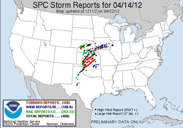
120414_rpts

120414_rpts

04-14-2012 CHASE LOG:  NEBRASKA There was a lot of hype leading up to this event with the Storm Prediction Center (SPC) issuing a moderate risk on Day 3 and high risks on Days 1 & 2.  This was all for good reason as a deep and strong upper trough was set to eject out of the Rockies and lead to a volatile weather situation with a risk for long track tornadoes, extremely high winds, and large hail with any storms that would materialize through much of the Plains from TX to NE.  The set-up included an area of low pressure centered across northeast CO with a warm front lifting to near the KS/NE border and a dryline extending south of the low into western KS.  These fronts were expected to be the focusing mechanisms for an outbreak of severe weather and tornadoes, especially right near the warm front and in the warm sector ahead of the dryline.

Wes Hyduke and I left Burnsville the day before and stayed in Omaha, NE for the night, fully expecting to have to drive west into NE the next day.  We awoke to thick fog and low stratus and realized the moisture had returned and we were clearly north of the warm front.  The system had slowed down from previous days and we realized that we had to position further to the west, so we left early and drove on I-80 to Grand Island, NE to reevaluate there.  Towards the noon hour, convection already started to break out across western KS and quickly move to the northeast.  A PDS tornado watch was issued 10:45am as a result of this first round of convection developing due to a strong low level jet in air that was already unstable as noted by the 1500-2000 j/kg of MLCAPE  and 40-60 knots of effective bulk shear.  We decided to head south on Hwy 281 out of Grand Island to meet up with these initial storms near Nelson, NE.  These storms had been tornado warned but the main threat was large hail and the storms were already starting to congeal into a cluster as they moved northeast into NE.  These were not impressive looking enough to keep us on these storms as we thought the main show would be later in the afternoon along the dryline.  A mesoscale discussion was issued at 1:41pm highlighting this risk across southwest NE into northwest KS.

As more intense supercells developed along the dryline further south in western KS and western OK, and were quickly becoming tornadic and cyclic, we almost decided to bail on our northern area and head to the northernmost cell approaching the Great Bend, KS area, which later produced a long track tornado that passed very close to Salina, KS.  This area had extremely high storm relative helicity and had MLCAPE approaching 3000 j/kg.  We decided to stay north on the dryline as there were some cells starting to get going and thought we had just as good of a chance to see a tornado here, although in an environment that was less unstable than further south.  These storms were slow to develop for some reason, but one storm did manage to break through and intensify.  This was our storm.  We traveled northwest from Alma, NE towards Oxford.  The storm was looking better and starting to get some incredible structure and fast, albeit cool, inflow air with an impressive tail cloud into a lowered base.  A wall cloud soon developed around 4:30pm and we witnessed a rope tornado for around 3 minutes near Oxford at 5:18pm.  After the tornado died, we followed the storm on Hwy 34 northeast in hope of the storm producing again, but that ended up being the only tornado that storm produced.  We did witness a large funnel that was ¾ of the way to the ground (may have touched down) near Gibbon, NE when the storm was not even tornado warned but had a nice couplet on radar.  You can see this at the end of the video below.  It soon became too dark to see much so we traveled to Columbus, NE to have our steak dinner after a successful chase!  Overall, I thought this would be a bigger day for tornadoes in NE than what it ended up being.  It was clear to me that it was just not as unstable with slightly lower dewpoints this far north as what was taking place in KS and OK, although the low and deep layer wind shear seemed to be similar.