JUNE 10TH, 2012 MINNESOTA - SHELF CLOUDS GALORE
06-10-2012: MINNESOTA A short chase log here as this was not a significant severe weather day, but did have some photogenic opportunities. I had to work this morning and took off right after work to chase with MaryLynn across central MN. There was a slight risk for most of MN with a 5% tornado risk. This was a cold front setup for the area, which usually means one thing for storm mode…linear storms with wind damage and shelf clouds. That is exactly what we got as we progressed northwest on Hwy 10 and then north on Hwy 25 through Foley and north from there to get out ahead of initially more isolated storms developing well out ahead of the cold front and more linear storms further west. These storms were developing in a marginally unstable environment with dewpoints only in the lower 60s, so they had a tough time getting going and even holding together. We decided to let those storms go to the north and chase west on 153rd St and Hwy 27 through Pierz to intercept the severe warned line of storms approaching Little Falls. After getting through Little Falls and south on Hwy 10, that is where we saw our first shelf cloud of the day as the line moved in. We were able to stay just ahead of the storms as we moved southeast on Hwy 10, due to the orientation of the line, while we attempted to intercept the most intense part of the storm southwest of Royalton on the Great River Road. At this point, we were slammed by some estimated 40 mph winds, small hail, and intense rainfall rates. There must have been higher winds to the south, as we encountered a bunch of trees down on the road as we approached Sartell from the north on Hwy 1. We were able to get around the trees and get back through Sartell on Hwy 10 and eventually back onto I-94 to get ahead of the line once again. We stopped in Monticello just off the exit to take more pictures of the shelf cloud and then traveled back home for the night to Burnsville, where we ended up getting hit by another intense storm right at sunset. This storm apparently produced a tornado near Belle Plaine at 8:15pm, but was embedded in the storm when it looked like it was producing straight line winds.
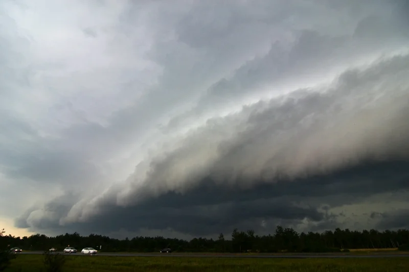
Shelf cloud approaching us near Little Falls, MN.
Well structured shelf cloud getting closer south of Little Falls, MN.
Another shot of the cool looking shelf.
Looking to the north as the shelf was moving over.
Interesting feature here near Royalton, MN. This looked like a storm base with a notch in the line, shear markers on GR3, and some rotation shown on the velocity imagery at the time. It rocketed by us to the north fairly quickly and looked to gust out a short time later.
Tail cloud on the storm base as we crossed the MS River near Royalton, looking north.
Shelf cloud approaching Monticello, MN.
Shelf cloud about to overtake us in Monticello, MN.


