JUNE 22, 2017 NORTHERN IOWA: TERRIFIC SUPERCELL STORM STRUCTURE
Took a trip down to Iowa with my wife, MaryLynn, to see the Bridges of Madison County, see other sites, and then chase some storms. There was not a lot of expectations on this day with limited deep layer shear and instability, but storms were likely to form on and ahead of the cold front in an environment that had been worked over some by rain and storms early in the day. A storm that did form in northern Iowa somewhat surprisingly became a supercell and took on terrific structure during the early to middle part of its life cycle. This was the one good storm of the whole event and one of the few that became severe thunderstorm warned, as it formed and tracked along a remnant outflow boundary and cold front intersection. There was never a severe thunderstorm or tornado watch issued for the area as any severe storms were limited in coverage.
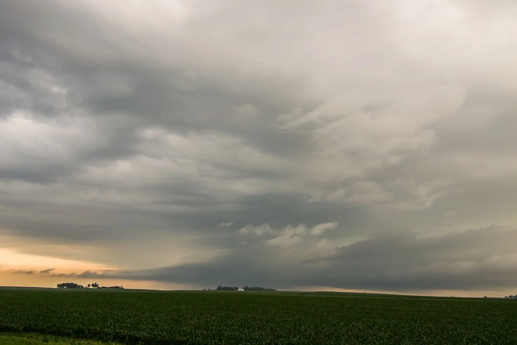
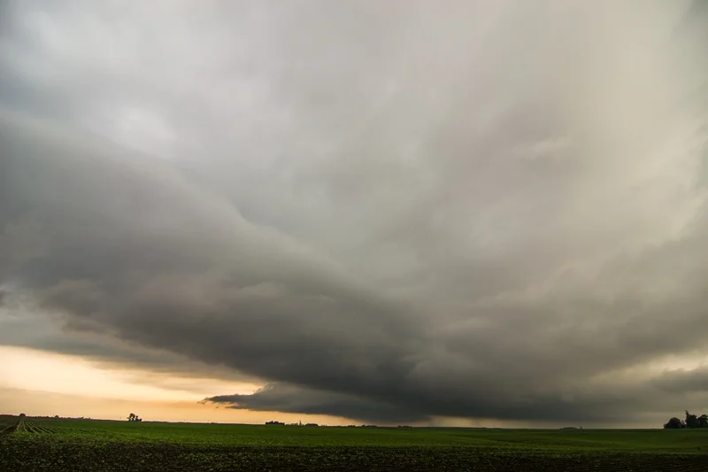
My favorite shot of the day of the incredible storm structure and striations with fully established shelf cloud near Hansell, Iowa. Photo out of sequence from the others below.
Multiple inflow tails to the base as we approached from the north near Meservey, Iowa.
Got a little closer and I was surprised at the well developed wall cloud that had formed on the southeast side! Clearly can see the multiple inflow bands and I think the band of clouds right in front of us in this image is the actual outflow boundary the storm was rooted on.
Extremely low cloud base on this storm. Looking west from near I-35 southeast of Meservey, Iowa. The storm lost the wall cloud here but was still showing signs of strong inflow and rotation in a few spots.
Intense rain and hail core between Meservey and Chapin, Iowa. Storm is severe thunderstorm warned at this point.
Awesome shelf cloud on the storm near Chapin, Iowa.
Looking the other direction from the previous image, to the north as the core of the storm was approaching. Still some inflow into this storm as you can see from the bands on the left side.
Shot of the storm between Chapin and Hansell, Iowa with grain bins in the foreground and shelf cloud about to overtake.
Unreal structure near Hansell, Iowa!
Looking northeast at the vault region of the storm and shelf cloud at the base.
Storm looking mean as it gets near.
STORM PREDICTION CENTER OUTLOOKS
Mesoscale Discussion issued by SPC at 9:09 PM CDT as isolated severe thunderstorms were ongoing along the front. They did not analyze the outflow boundary through north-central and northeast Iowa, but there appeared to be one there. Never did issue a severe thunderstorm watch since the storm coverage was low.


