JUNE 29, 2017 NEBRASKA & IOWA SUPERCELL: GOOD STORM STRUCTURE
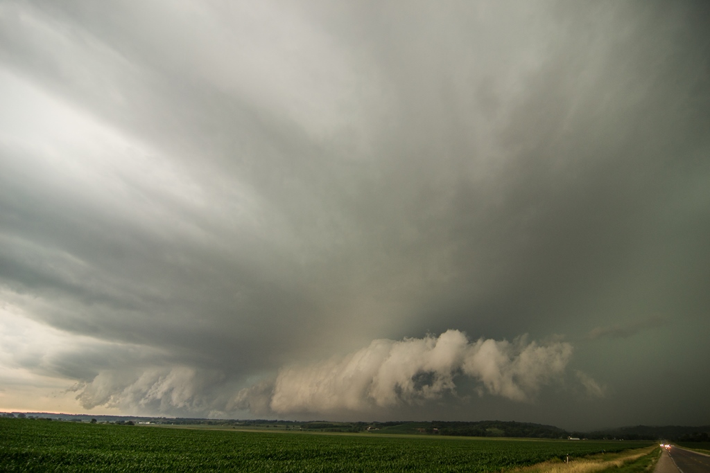
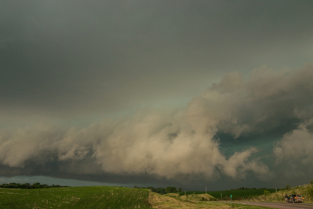
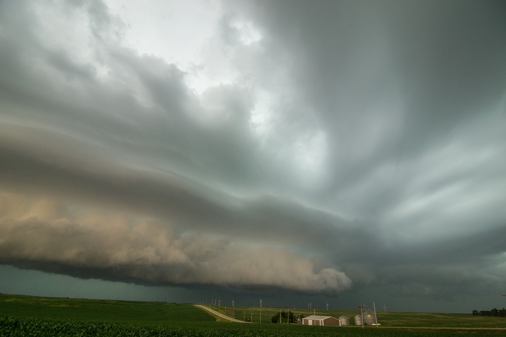
Chased a supercell thunderstorm out of northeast Nebraska through Sioux City, Iowa where it produced baseball size hail, and into northwest portions of Iowa. This storm was tornado warned near Sioux City before becoming outflow dominant and producing a spectacular shelf cloud near Mapleton, Iowa. The storm had some really good structure for a while (see photos below). The video is primarily a time-lapse from two different segments of the storm.
Terrific storm structure near Mapleton, Iowa at the end of the chase. This photo is out of sequence with the others below.
Storm was tornado warned at this point, directly over Sioux City, Iowa. This area in the center of the image was the action area where there was notable rotation and a ragged, somewhat high-based wall cloud.
Another shot of the wall cloud only a few miles south of Sioux City, Iowa. This was taken looking northeast. I quickly had to drive back into the core on the left side of this image to get across the Missouri River to get ahead of the storm into Iowa. I encountered quarter-size hail and thankfully missed the baseball hail that was reported in Sioux City.
Wall cloud on the tornado warned storm near Owego, Iowa. This was as close as this storm came to producing from my vantage point.
Storm now becoming outflow dominant and forming a shelf cloud near Smithland, Iowa. Lots of mid-level inflow bands still occurring into this storm here.
Another shot of the storm east of Smithland, Iowa as the shelf cloud became more prounounced.
Short time later as the shelf cloud approached.
Was interesting how a part of this shelf started to take on a different shape here. There was solid inflow occurring on the right side into this base...almost looked like a wall cloud attempting to form. Indicated storm may not be true outflow dominant here and was trying to focus an area of rotation with this lowering.
Southern end of the shelf cloud, but still can see a few locations where inflow may be occurring in the notches.
Shelf cloud approaching. Like that wavy appearance to the striations above the shelf.
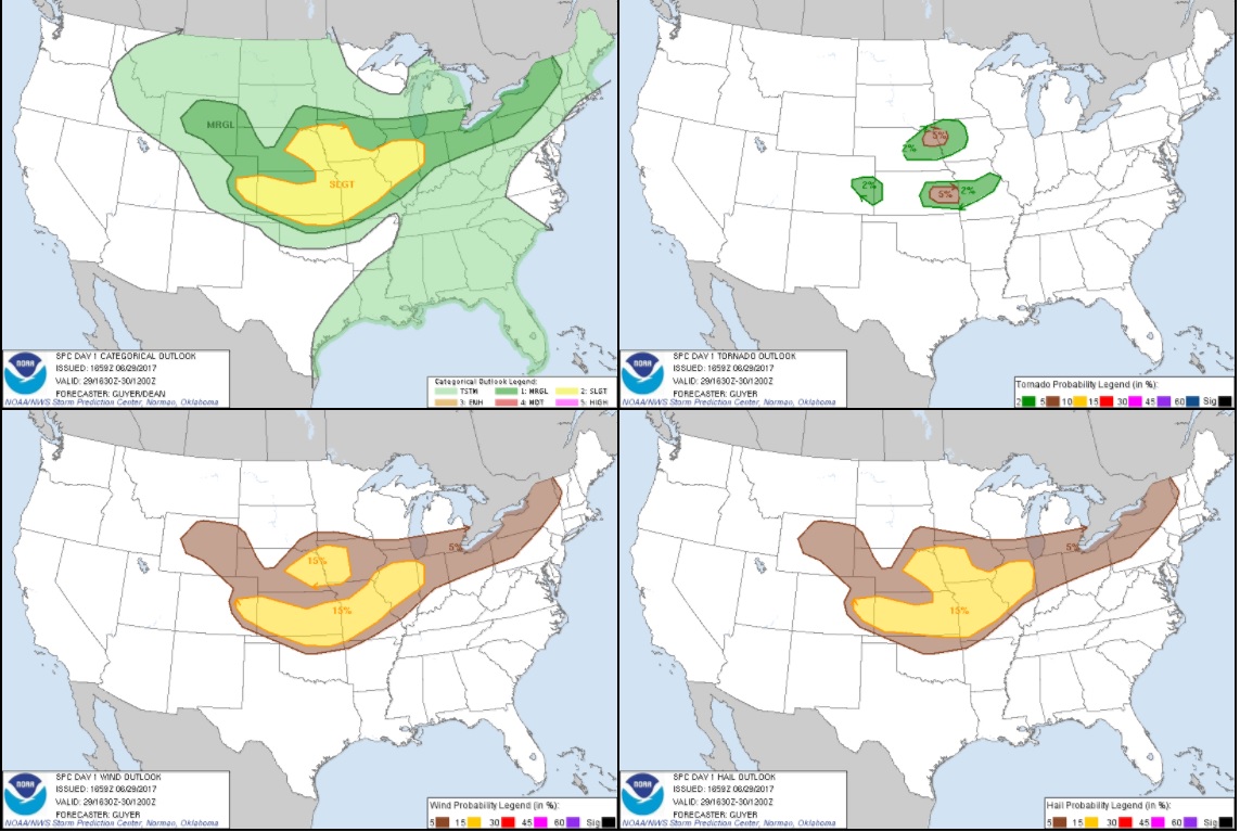
STORM PREDICTION CENTER OUTLOOKS
Mesoscale Discussion issued at 2:26 PM CT highlighting a likely severe thunderstorm watch upcoming. Storm I chased was on the warm front ahead of the triple point.
Severe thunderstorm watch issued at 3:40 PM CT until 11:00 PM CT across eastern Nebraska and western Iowa.


