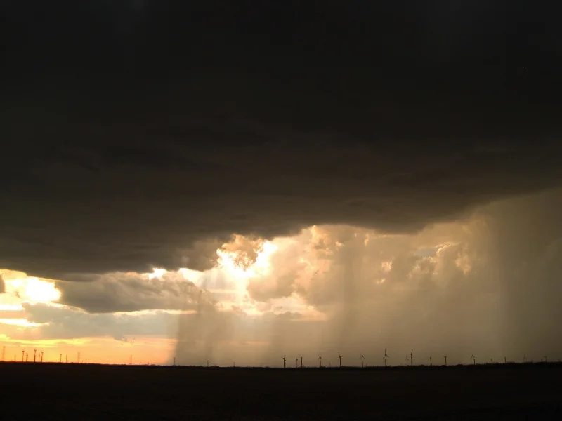
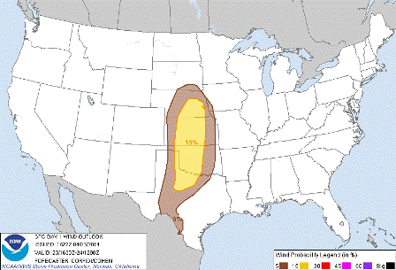
JULY 7TH MINNESOTA: SEVERE STORM THROUGH SOUTHERN TWIN CITIES

 
DSC_1132
DSC_1132

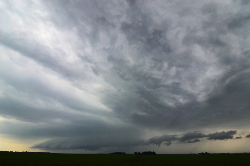
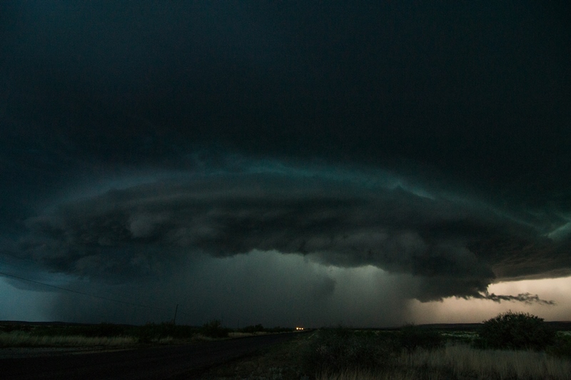
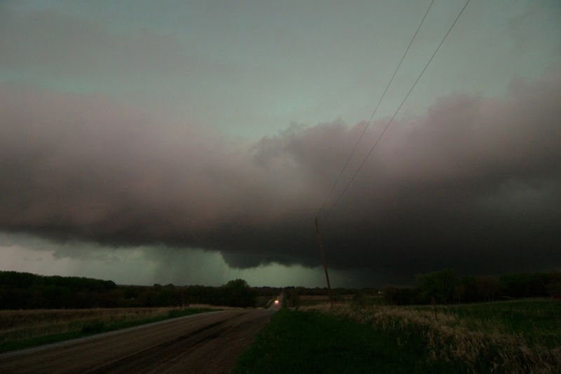
Severe warned storm with developing wall cloud over Chaska, MN.

DSC_1135
DSC_1135

Wall cloud becoming fully mature as the storm moves closer to Shakopee High School.

DSC_1137
DSC_1137

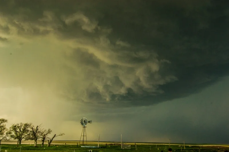
Wall cloud starting to gust out a bit but still holding together.

DSC_1139
DSC_1139

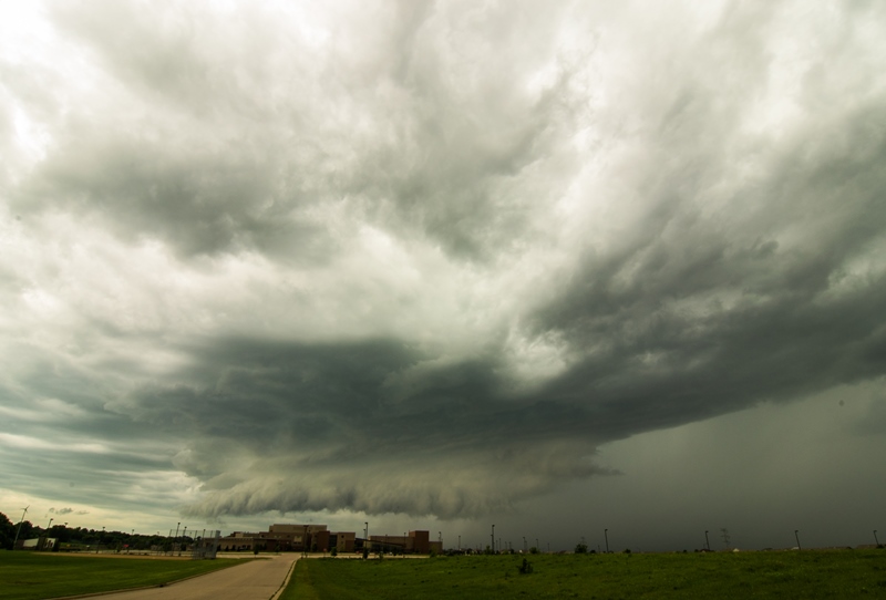
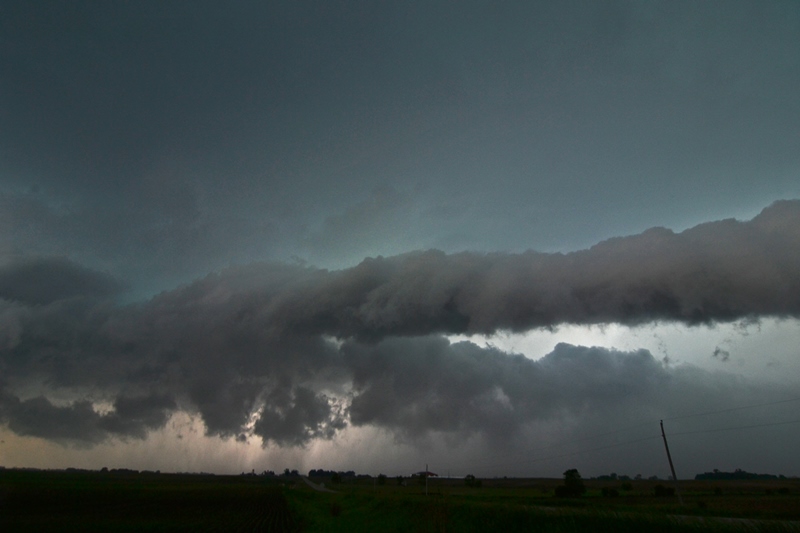
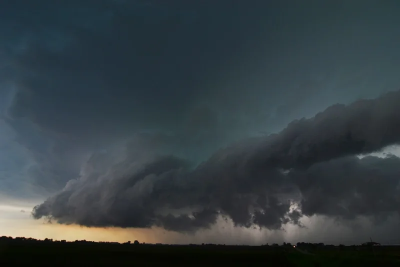
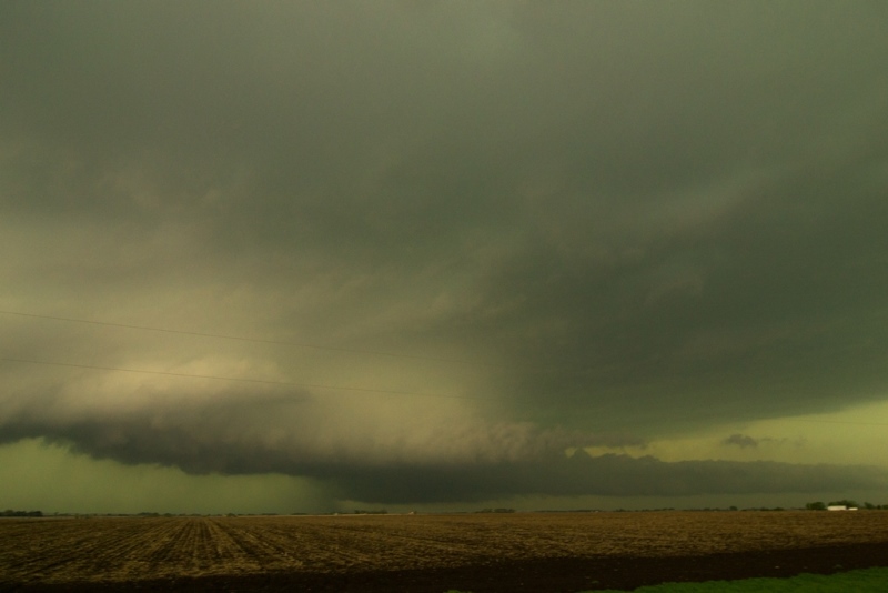
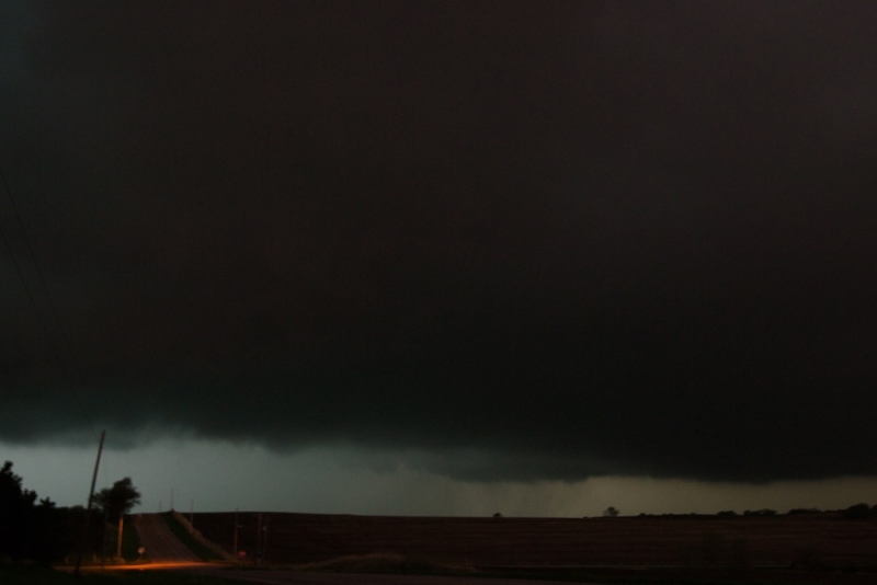
Storm about to move through Shakopee, MN.  Broad lowering that is becoming outflow dominant with core to the right.

DSC_1142
DSC_1142

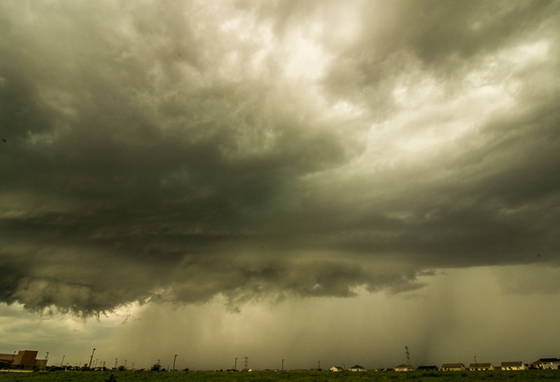
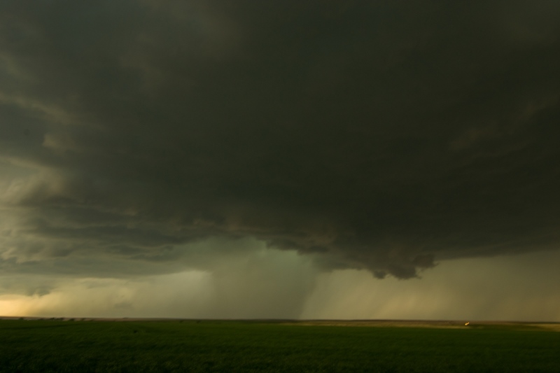
Strong core here with 1 inch hail being reported at this time near Shakopee.

DSC_1147
DSC_1147

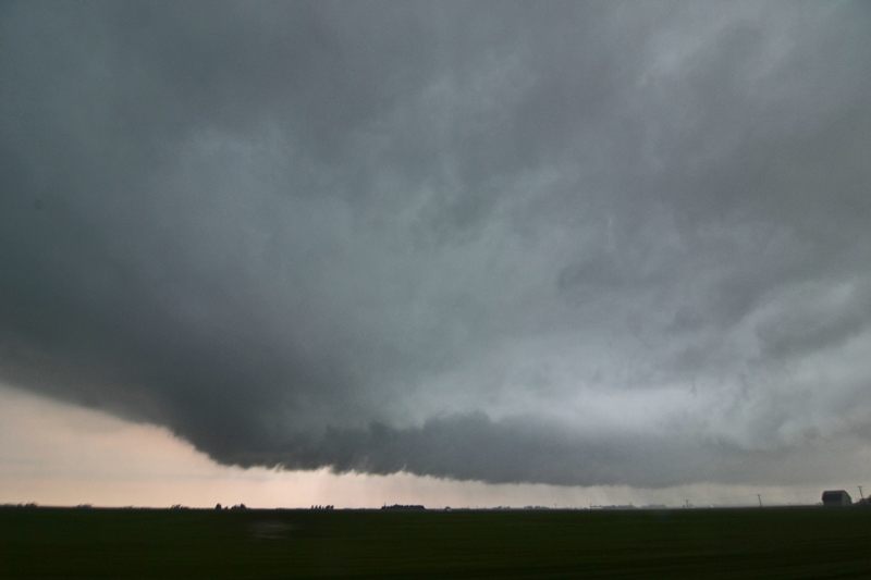
Another shot of the lowering  and storm core as it was approaching.

DSC_1151
DSC_1151

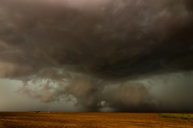
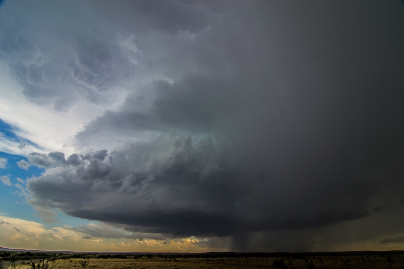
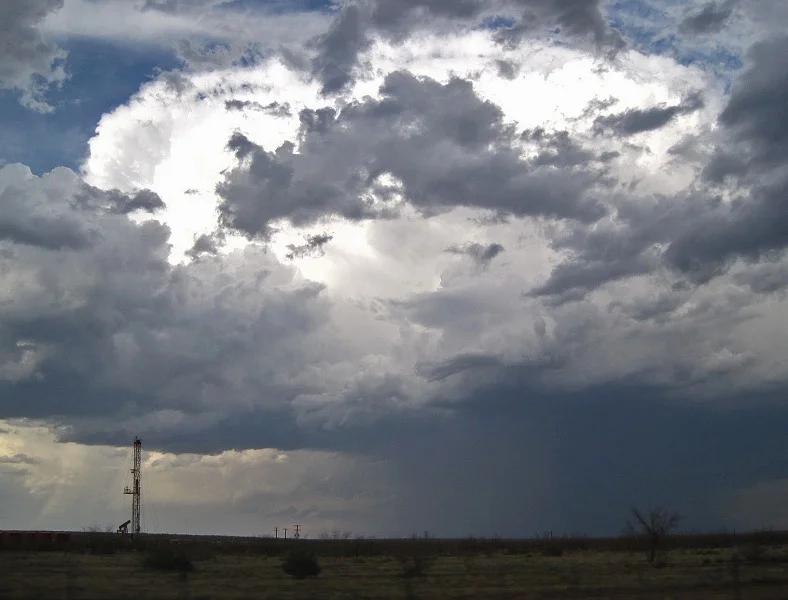
My favorite shot of the day...small but intense updraft at the back of the storm over Burnsville, MN taken from Lac Lavon Park.

DSC_1153
DSC_1153

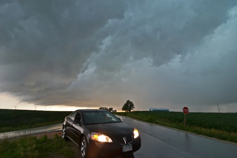
Wide shot of this updraft tube and associated storm taken looking southeast from Lac Lavon Park in Burnsville.  This storm produced 1.75 inch hail in Burnsville.

STORM REPORTS:

140707_rpts_filtered

STORM PREDICTION CENTER OUTLOOKS:

SPC Outlooks
SPC Outlooks

JUNE 29TH IOWA: MULTI-VORTEX TORNADO NEAR STANHOPE & FUNNEL

 
DSC_1084
DSC_1084

Approaching the first severe warned storm of the day near Humboldt, Iowa.

DSC_1091
DSC_1091

First getting on the tornado warned storm near Stanhope.  Nice base and low inflow tail with mid level inflow streaming into the updraft.  Storm had a massive hook echo forming around this time.

DSC_1092
DSC_1092

Looking directly at the hook wrapping around the storm and forming into a mesocylone northeast of Stanhope at 7:21pm.

DSC_1094
DSC_1094

Forming a wall cloud a minute later.

IMG_1736
IMG_1736

Our position in the crosshairs relative to the hook echo at 7:22pm.

DSC_1097
DSC_1097

Mesocyclone starting to rapidly rotate and tighten up at 7:32pm.

IMG_1735
IMG_1735

Video still of the tornado 3.5 miles east of Stanhope a short time later.

DSC_1107
DSC_1107

After seeing the tornado near Stanhope, this funnel developed near Garden City, IA at 7:58pm.

DSC_1108
DSC_1108

Underneath the base of the storm near Garden City.

DSC_1121
DSC_1121

Heading home up I-35 after a fun and successful chase day.

STORM REPORTS:

140629_rpts
140629_rpts

STORM PREDICTION CENTER OUTLOOKS:

SPC Outlooks
SPC Outlooks

JUNE 29, 2014 CHASE LOG: IOWA

  This was a chase day in which my gut feeling that not much was going to happen in the target area was completely wrong.  Luckily I had a friend, Wes Hyduke, coaxing me into leaving after work and chasing this set-up in central IA.  The reasons I did not have a good feeling about the day were because of morning and ongoing convection with quite a bit of cloud cover, as well as the outflow boundary/warm front well to the south near the Des Moines area, which appeared to be total displaced from the better 50-60 kts bulk shear to the north across MN.  Surface winds feeding any storms that developed were weak, on the order of 10-15 kts at the most.  The environmental conditions that this area DID have going for it were that the clouds thinned/cleared out through the afternoon, allowing for unstable conditions to develop in the vicinity of 3,000-3,500 j/kg of MLCAPE, dewpoints in the lower to middle 70s, bulk shear an ok 35-40 kts, and an outflow boundary from morning convection that was slowly receding back to the north towards the Ames, IA area.  It really was a tough forecast and models did not appear to be handling the situation very well with several completely different solutions and missing a lot of current convection.  All in all, I was on the fence about going but Wes saw the environment and assured me that at least some decent supercells would develop along and north of the outflow boundary.

We left the Twin Cities shortly after 2pm and traveled south on I-35 to Clear Lake, IA.  Right as we were leaving, the Storm Prediction Center (SPC) issued a mesoscale discussion, outlying the increasing risk for severe thunderstorms across eastern NE and western/central IA as the afternoon progressed.  They noted the decreasing cloud cover leading to destabilization as well as steep mid-level lapse rates greater than 7 C/km, and also the more backed surface winds across IA that may enhance the tornado potential.  A Tornado Watch was soon issued for the area at 4:05pm, lasting until 11pm CDT.

After having an early dinner in Clear Lake, we traveled south on I-35 to the Hwy 3/Hampton exit as a thunderstorm was developing out towards Storm Lake.  We went west on Hwy 3 and then north on Hwy 169 and then west to intercept the storm northwest of Humboldt.  This storm had looked good for a moment and actually had a nice wall cloud on it as we caught up to it initially.  This storm soon crapped out and weakened considerably as we followed east through Bode.  Failing to get AT&T data, our only option was to head east and stay with the storm/get ahead and see how the radar looked when we got data.  As we went back east on Hwy 3 with our weak and non-interesting storm, we were able to get data again near Clarion.  Right away the radar lit up with a couple already severe warned storms that appeared to be right on the outflow boundary to our south.  We pushed south on Hwy 69 and punched the leading severe warned storm near Hwy 20 east of Webster City.  This is when the cell to the southwest became tornado warned with a nice hook echo forming.  I decided to make a move to punch through the forward flank core on 270th St and then south to get ahead of the hook and in the notch of the storm near the intersection of Neely Ave and 330th St/D56.

When we got to this intersection, you could visually see the reflectivity ball coming around the south side of the hook that we could see on radar.  There was some rotation right in the notch on the north end of this ball of rain with a lowering tucked away closer to the main core to our northwest.  Soon, rotation began to increase with a mesocyclone becoming more apparent in this hook echo.  We noticed a surge of rear flank downdraft (RFD) winds coming around the west side of the hook and around the mesocyclone and I figured something was going to happen here soon.  At this point, it was getting close to us so we moved east down the road to Nelson Ave, passing the Stanhope Fire Dept on the way.  Right as we stopped, I noticed a vorticy kicking up dirt underneath the meso and THERE WAS THE TORNADO!  We watched as vortices condensed, kicked up dirt aggressively, and spun back up into the low cloud base.  This happened several times with a few vortices at once on occasion for about 2 minutes at this location, 3.5 miles east of Stanhope.  We continued to move east with the storm on 330th/D56 towards Jewell as vortices continued to kick up debris clouds underneath the meso.  It was interesting as this storm had right-turned and the tornado and storm were traveling east-southeast, rooted right on the outflow boundary from the earlier convection.  We got ahead of the meso on Hwy 69 south of Jewell as a large funnel cloud formed once again but did not touch down.  We then traveled east through Randall and crossed back over the interstate on 380th St/D65 and then got ahead of the storm in the small town of Garden City.  Just north of town, the storm produced another low funnel that may have touched down but not quite sure as we could not confirm.  After traveling east again over Hwy 65, we stopped again to take photos of the storm that appeared to be cycling at the time and not looking as great.  All of a sudden the darn gas light comes on and we realized we were almost running out of gas!  At this point, there was nothing we could do.  We had to go back to Hubbard to get gas or we were going to run out.  There was no way we could get back in front of the storm before sunset so we decided to end the chase day here.  Unfortunately, the storm produced another and more photogenic tornado further east near Conrad that we would have been all over if it was not for the gas issue.  Oh well, a great chase day that was rather unexpected for me going into it.

JUNE 14TH NEBRASKA: TORNADO WARNED STORMS

 
DSC_1037-2
DSC_1037-2

Lucky for me to catch this lightning shot since I was shooting out the car window at the time.

DSC_1040-2
DSC_1040-2

Mammatus on the storm south of Fullerton, Nebraska.  Scenic and wide open area for this storm to form in.

DSC_1043-2
DSC_1043-2

Base of the left split storm as it was starting to break off to the north near Fullerton.

DSC_1050-2
DSC_1050-2

The southern supercell as it was starting to form a wall cloud south of Genoa, Nebraska.  This storm became tornado warned a short while after this was taken.

DSC_1055-2
DSC_1055-2

Wall cloud on the tornado warned storm near Silver Creek, Nebraska.  Intense core on the right.

DSC_1056-2
DSC_1056-2

Wall cloud becoming better organized with solid inflow at this point.  Storm merger taking place and starting to look messy on radar.

DSC_1062-2
DSC_1062-2

Short while later as an area of rotation attempted to become more focused, but soon fell apart.

DSC_1066-2
DSC_1066-2

Blurry photo but this was a funnel cloud on the storm near Monroe, Nebraska.  Finger hanging down from the storm in the center of the image.

STORM REPORTS:

140614_rpts_filtered

STORM PREDICTION CENTER OUTLOOKS:

SPC Outlooks
SPC Outlooks

JUNE 11TH MINNESOTA: SHELF CLOUDS & GUSTNADO

 
DSC_0997
DSC_0997

Lowering on the storm over Ortonville, Minnesota.  Actually was trying to form a wall cloud here!

DSC_1008-2
DSC_1008-2

Still inflow into the storm as noted by the tail with a weak bowl shaped lowering under the storm.  Starting to form a shelf cloud on the southern end.

DSC_1010-2
DSC_1010-2

Shelf cloud fully developed on this storm near Appleton, Minnesota.

DSC_1014-2
DSC_1014-2

Nice looking shelf cloud about to overtake us with some gusty winds.

DSC_1024-2
DSC_1024-2

A different storm with actually some decent structure near Kerkhoven, MN!  Lowering underneath that held together for a while.

DSC_1029-2
DSC_1029-2

Another shot of this storm as it was approaching my location.  Lowering underneath is becoming more ragged.

DSC_1031-2
DSC_1031-2

Cool roll cloud that developed out ahead of the storm as outflow was starting to really take over.

DSC_1032-2
DSC_1032-2

Another view as the roll cloud was moving over with the storm base to the left where it still appeared to have some inflow.  This base to the left is what eventually formed the gustnado near Pennock.

STORM REPORTS:

140611_rpts_filtered

STORM PREDICTION CENTER OUTLOOKS:

SPC Outlooks
SPC Outlooks

JUNE 11, 2014 CHASE LOG: MINNESOTA

  Making the best out of a marginal situation is what this day was all about.  I awoke in the morning to a Slight Risk for severe weather and a 5% tornado risk across west-central and northwest MN.  I had been watching for this potential chase for days leading up to the event, but it never looked like a slam dunk for severe weather and especially for tornadoes.  The main issues for the day were the weak low and especially mid-level lapse rates as well as dewpoints only in the upper 50s to lower 60s.  MLCAPE was only expected to get into the 500-1,000 j/kg range at the most, so instability was also rather low and confined to a narrow corridor ahead of the cold front.  The surface set-up included a low pressure center east of Aberdeen across northeast SD and a stationary front to the east-northeast through “The Hump” are of western MN and into north-central portions of the state.  A trailing cold front slowly advanced eastward through eastern SD and into southwest MN.  Bulk shear was not bad but not great, and on the order of 40 kts later in the day as the upper trough approached.  The plan was to play the triple point area near and just southeast of the low in the vicinity of Hoffman, MN and hope that supercell and tornado potential would be maximized here.

I left my parent’s place in southern MN by 9am and headed northwest towards Alexandria.  Here is where I met up with a few other chasers and waited for things to become clearer.  This area was right on the stationary front while an area of low pressure was moving towards from northeast SD.  Storms began to form near the low and along the cold front by mid-afternoon and looked very weak on radar.  SPC issued a mesoscale discussion for the area at 3:36pm, basically saying that a low risk for severe weather existed and there would only be a low probability of a watch issuance.  They even downgraded the 5% tornado to a 2% for the 2000Z update.  Shortly thereafter, one storm caught my eye that was near Webster, SD that was intensifying and had a 40k foot echo top.  This storm was near the triple point and looked to be the best of the many that were starting to fire around it.  I made my way down from Alexandria through Morris and west on Hwy 28 to Graceville, MN.  I then went south on Hwy 75 to intercept the storm in Ortonville.  The storm did have a lowering on it as it crossed the river towards us to the north of Ortonville, but this looked non-threatening and the storm was not warned at the time.  I was able to stay ahead of the storm on Cty Rd 10 for quite a while, stopping to take photos and video at times as the storm was looking interesting but with more shelf-like, outflow features as the storm started to move past maturity.

A new storm began to form to the south near Appleton and I moved south on Hwy 59 to Hwy 12 to intercept this storm.  Again, this cell never was severe warned but did have several lowered areas underneath the base and had nice structure at times.  Upon reaching Kerkhoven, I followed to the northeast on Hwy 6 and the road turned into Cty Hwy 13.  At the intersection of 13 and Cty Hwy 7, I was able to get out ahead enough to set up the tripod and take some video as well as a number of photos.  The storm had good structure for a while, while the northern end began to gust out upon reaching me.  I was about to let the storm core me, when I noticed a dirt plume to the south.  This was where the storm appeared to have a hook appendage on radar and still had inflow/outflow balance.  There was an action area above that looked like a ragged mesocyclone with a lot of turbulent undulations.  I followed south on Cty Hwy 7 back to Hwy 12 and then east through Pennock.  Here is where the dirt plume really looked like a large gustnado.  There was also a lot of dirt being blown back to the east on the south side of the storm where an RFD may have been in place, then curling back ahead and into the storm with the inflow.  It certainly looked interesting and Melanie Metz has a nice photo of what looks like a funnel and dirt being kicked up underneath shortly before the dirt plume got larger.  I followed through Willmar where dirt was still being kicked up and when it really looked like a gustnado.  Another formed to the northeast of Willmar as I continued to the east on Hwy 12.  It soon was too dark to see much and the storm began to weaken, so I progressed back home for the night.  A nice chase considering there were no severe warnings and it was such a marginal type of day!

MAY 26TH TEXAS: INTENSE SUPERCELLS & 3 WEAK TORNADOES

 
DSC_0891
DSC_0891

Tornado warned storm with rotating wall cloud near Lenorah, TX.  This produced a defined dirt swirl right underneath the action area for the first tornado of the day, albeit very weak.

DSC_0895
DSC_0895

Sharp inflow 'beaver' tail into the storm as wall cloud began to lose some definition near Lenorah, TX.

DSC_0898
DSC_0898

Our second tornado warned storm of the day.  Awesome looking supercell with great structure, wall cloud, and intense core southeast of Stanton, TX and northwest of Garden City, TX.

DSC_0903
DSC_0903

Looking left as the rear flank downdraft was coming around the south side of the storm and kicking up a dust plume.

DSC_0908
DSC_0908

Really nice looking supercell with wall cloud underneath the vault updraft region of the storm near Garden City, TX.

DSC_0912
DSC_0912

Zoomed in view of the wall cloud underneath this storm.  There was solid rotation going on with this feature, as you can see in the video at the time.

DSC_0920
DSC_0920

 Beast of a supercell with inflow bands coming in from all directions and wall cloud near Garden City, TX.

DSC_0922
DSC_0922

I like this shot.  Supercell moving right at us an oil pump continues to work on.  Symbol of West Texas.

DSC_0929
DSC_0929

Fast rotating wall cloud at this point, with focused dirt swirl underneath.  What looks like a funnel reaching down as well.  Second weak tornado of the day.

DSC_0944
DSC_0944

Typical Texas tank of a supercell storm.  Nice striations indicating a rotating storm and inflow bands coming in from many directions.  This was looking northwest from near Water Valley, TX.

DSC_0949
DSC_0949

Another shot of this storm as it started to get closer.  Notice large wall cloud underneath.

DSC_0951
DSC_0951

Closer view of the wall cloud underneath this intense storm.  Not many people wanting to drive up the road into this thing!

DSC_0958
DSC_0958

Wall cloud starting to gust out as it approached us.  Reports of baseball size hail with this storm at this time.

STORM REPORTS:

140526_rpts_filtered

STORM PREDICTION CENTER OUTLOOKS:

SPC Outlooks
SPC Outlooks

MAY 26 2014 CHASE LOG: TEXAS

Written by Rich Hamel: (www.bostonstormchaser.com/)

  Finally a real adrenaline pumping chase day! The plan was to find the dryline intersection with the outflow boundary from the previous day’s storms and wait. We drove from Hobbs, NM to Big Spring, TX and had lunch.  By the time we’d finished up lunch, a line of storms was firing to our northwest near Seminole, so we headed out of town to intercept the best looking cell with the plan being to chase that cell, then as storms fired down the line drop to the tail end storm, repeat, and repeat again. We didn’t have long before we intercepted the first storm as it went severe and was soon tornado warned near Patricia around 3 PM. We stopped and observed a big wall cloud low to the ground and within a minute or two there was a persistent dirt swirl on the ground with cascading motion above, tornado number one for the day! That tornado lasted only a minute or two, and the storm was right turning hard so we had to get ready to leave. We observed the rear flank downdraft winds plowing dirt into the sky and had to beat feet to get out of the way, running south down Rt. 137 towards Lenorah. We got plastered by flying dirt and strong cross winds as we blasted south, and a large spin up (probably a gustnado but can’t rule out a shearline tornado) formed just west of my van as we headed away.

The storm had quickly become a high-precipitation monster, making visibility into the notch area very difficult, and by now the chaser hordes had arrived, hundreds and hundreds of vehicles worth. This was by far the most difficult portion of the day, finding ways to safely navigate all of the traffic pulling in and out of every decent viewing position while trying to keep our four vehicles together.

By 4 PM, the storm was totally HP and any tornado that was in there was completely rain wrapped (in fact there were reports of a rain wrapped tornado crossing I-20 near Coahoma later), so we decided to drop to the next storm in line which was now becoming quite severe. We passed through Big Spring again and headed west on I-20 to intercept. At this point the storm had a tremendous radar return with a “scorpion tail” hook echo on radar indicating rapid rotation. As we charged towards the storm, we couldn’t see the updraft through the massive precipitation core that was racing towards the highway with baseball sized hail, so we got off the highway and headed south on Rt. 33 to get around the core and beat the storm to Garden City. We stopped for a minute to view the storm and had a neat vantage with our new storm our west, and our old storm chugging away to the northeast. We immediately saw another big dirt bob in the distance to our west but concluded that this was again RFD winds plowing around the south side of the storm. We continued south, now once again swamped in the convoy of chasers that had finally abandoned the northern storm.

We leapfrogged through the chaser-gaggle, heading east on rt. 158 at Garden City as the storm grew to peak intensity, with 3-4” hail and a massive hook echo still on radar. It was also getting HP quickly and ingesting an incredible amount of dirt from the dry fields in the area so it was getting difficult to see into the inflow notch. We finally got ourselves way out ahead of the storm and found a south pull off to set up and watch as the storm came right down the highway after us. The storm now had a big wall cloud and was rotating like crazy.

We stayed at that location for about 15 minutes as the storm closed in quickly, with RFD dirt plumes, gustnadoes, and all kinds of flying dirt in the air. Soon it was time to get out of the way, so we headed back to the end of the road when Roger started yelling to stop and sure enough, to our west there was a weak tornado occurring, wrapped up in rain. We waited very briefly as it closed on us and seemed to dissipate, then everyone in my van starting yelling and I turned to see a tornado forming less than 100 yards from the van! We hit the gas and got out of there as the tornado blasted through the field south of us then quickly dissipated.

Our next issue was that we were now getting into the Mosquite region of Texas, with lots of trees and big ridges on either side of the road so it was difficult to see. There were a variety of reports of a rain wrapped tornado, so we stayed well ahead of the storm. At one point we stopped for a few minutes and may have gotten a look at a small cone tornado off the distance but can’t confirm. After a brief stop south on 163 south of Sterling City, we headed down Rt. 87 southeast towards Water Valley. On the way we were able to see a short duration rope tornado coming from the storm, though I didn’t see it as I had to keep my eyes on the road (the downside of driving on chase days sometimes).

Northwest of Water Valley we stopped at a rest area, turned the vans around, and waited for the beast of a supercell to come right to us. The structure was incredible! The storm had little tornado potential by now but was packing huge hail. We watched for about 30 minutes as the storm came to us and passed just to the north. Meanwhile, right behind that storm was another tornado warned storm, so once our previous storm moved out of the way we headed back up Rt. 87 to take a look, but at this point it was getting dark and the storm seemed to be getting seeded by the water cooled air blowing out of our previous storm, so we decided to call it a day and head into San Angelo for dinner. We did have a little moment of excitement there as just as we finished eating dinner it became obvious that if we didn’t get clear in about 10 minutes, the storm we’d left was about to pummel the town (and us) with tennis ball hail! We scrambled to get in the vans and blasted northeast of town, just getting clipped by the edge of the core as we got away. The rest of the right up to Abilene was uneventful.

Fantastic chase day with 2 great storms, 3 brief tornadoes (and maybe glimpses of 2 more) and not that much driving: only 460 miles for a 7 day total of 3523 miles.

MAY 25TH NEW MEXICO: TERRIFIC SUPERCELL STORM STRUCTURE

 
DSC_0837
DSC_0837

Looking right up the first storm updraft as it was developing near Eunice, NM.  This cell soon weakened and we bailed on it.

DSC_0841
DSC_0841

Our storm of the day exploding near Carlsbad, NM.  The third straight day we have chased a supercell near Carlsbad!

DSC_0847
DSC_0847

Storm was starting to mature, moving right at us to the east of Carlsbad.

DSC_0849
DSC_0849

Another shot of the storm with an oil pump and storage containers to the left.  Decent inflow bands into this storm and spread out anvil above.

DSC_0862
DSC_0862

Storm fully mature with beautiful, spiraled updraft and great structure to the west of Hobbs, NM.

DSC_0862
DSC_0862

Another shot with the setting sun providing some nice backlighting for photos.

DSC_0876
DSC_0876

A short while later as the severe warned storm held on to the great structure and intense core.

DSC_0883
DSC_0883

Storm starting to move very close at sunset.  Backwards C shape to the base, indicating there is likely a rear flank downdraft cutting in behind this storm.

STORM REPORTS:

140524_rpts_filtered

STORM PREDICTION CENTER OUTLOOKS:

Outlooks
Outlooks

MAY 25, 2014 CHASE LOG: NEW MEXICO

Written by Rich Hamel: (www.bostonstormchaser.com/)

  This has started to become the “New Mexico Tour”! We left Lubbock with two distinctly different targets for the day: South near Ft. Stockton where the outflow boundaries from the previous night’s convection intersected the dry line, or up near Roswell, NW where the models developed storms out of the mountains late in the day based on upslope flow and residual instability. With the two targets so far apart, we were going to have to commit to one or the other relatively early.

We headed south down to Midland, TX and stopped for lunch at the mall there. At the time, there was a single anchored tornado-warned supercell way down near Marathon, TX spinning away, but we decided it was too far to get to and ignored it. Still not sure if storms would fire in west Texas, we drifted west towards Monahans, by which time conditions were looking more and more favorable in the Carlsbad / Hobbs area yet again so we headed northwest through Kermit, TX and back into NM, stopping at the Allsups in Eunice to assess the situation, then heading west of town to wait for storms to develop. In the distance, we could see that the HRRR was correct about the Roswell target, with 3 cells exploding with rock-hard convection 90 miles north of us, two of which had big overshooting tops over the anvil clouds. We hung around in the gas fields (it’s amazing how much of southeastern NM and west TX are utterly dominated by the gas and oil industry, the whole region, for hundreds of square miles, smells like heavy oil from all the pumps and drilling) until a cell fired right over us. We headed north a bit to get out of the rain, and the storm seemed to be getting its act together with convection rolling over directly above us.

After a few more radar scans though, the storm was clearly not going to make it and we decided to blast north to try and get to the Roswell storms. We headed up Rt.18 through Hobbs and then up towards Lovington and watch as finally the storm that HRRR was predicting to develop over Carlsbad began to materialize, and soon the echo tops were heading for 40,000 feet. We were in easy intercept position so we aborted going after the Roswell storms and headed west out of Lovington, then south on 283 through the gas and cattle fields to get out in front of the storm, which was now right turning directly at us. As we got just east of the storm, it opened up a big hail core and split, with the left cell slowly dying off and the right mover intensifying rapidly with clear evidence of rotation on radar. After a couple of stops to observe the developing storm, we dropped south to Rt. 180 and drove right up to the base of the southernmost cell (after it had split again) between Carlsbad and Hobbs, and were treated to a beautiful structure-fest near sunset as the storm had a classic supercell look, with a corkscrew rain-free updraft, big precipitation core off the northeast, and numerous inflow bands flowing into the storm. The storm was a bit high-based, but at mid-levels it was spinning like crazy. The colors at sunset were spectacular, with the orange of the sunset behind the storm and the ice-blue base of the updraft, with white barber pole looking convection twisting up to the anvil.

After about 30 minutes of watching the beautiful storm, we headed east alongside it to try and get out in front more a more distant look of the structure, but darkness was falling and we eventually decided to go for lightning instead. This was one thing the storm lacked: it was not very electrified. We made a couple of lightning stops along Rt. 180, but the storm was weakening and we soon decided to call it a night. Luckily, our hotel for the evening was in Hobbs, so we were only about 10 minutes away!!

Another fun chase day. 399 miles for a 6 day total of 3062.

MAY 24TH NEW MEXICO: SUNSET SUPERCELL & POWER FLASHES

 
DSC_0800
DSC_0800

Supercell when we first got on it northwest of Carlsbad, NM.  Notice all of the inflow stingers into the storm!  Only one out there.

DSC_0807
DSC_0807

Wall cloud forming on the storm at 8:54pm MT.

DSC_0811
DSC_0811

Fully mature wall cloud, likely gusting out on the left but holding together on the right with a bowl shaped lowering.

DSC_0816
DSC_0816

Look closely: Very low bowl lowering on the right-center of the wall cloud.  Close to this point, we observed power flashes from the right side of the wall cloud/mesocylcone.  May have been a tornado, but not confirmed.

DSC_0818
DSC_0818

Another shot of the storm and more of the very good structure.

DSC_0819
DSC_0819

View of the wall cloud, lowering, and storm structure at 9:04pm...right near sunset.  Still a big cone shaped lowering in the center.

DSC_0829
DSC_0829

Awesome mothership after sunset!  The storm really was starting to gust out here and losing the wall cloud, but taking on amazing structure with strong outflow winds.

STORM REPORTS:

140524_rpts_filtered

STORM PREDICTION CENTER OUTLOOKS:

day1otlk_20140524_1630_prt
day1probotlk_20140524_1630_torn_prt
day1probotlk_20140524_1630_wind_prt
day1probotlk_20140524_1630_hail_prt

MAY 24, 2014 CHASE LOG: SOUTHEAST NEW MEXICO

Written by Rich Hamel: (http://www.bostonstormchaser.com/)

  A long, slow motion kind of day that looked like it was going to be a bust but ended with a bang! We left Lubbock in heavy rain around noon after doing a Weather 101 class, with Ft. Stockton as our target to play storms as they came north and hit the outflow boundary that had been surging southward from the overnight convection. The first issue we could see was that the boundary had already surged past I-20, though it was forecast to retrograde as the day progressed.

Elevated storms were already underway as we got to Odessa and we passed just to the north of a big left-moving hail storm as we headed west. We were posed with a number of different options: Head northwest to Carlsbad, NM into the area with the best overall conditions and where HRRR was predicting large isolated supercells just before dusk, or head to Ft. Stockton to intercept the tail end of the elevated storms that had gone severe, or target an area more to the southwest. We deferred the decision and headed to Monahans and waited….. then we repositioned to Pecos and waited…. and watched as one of the storms to the east went tornado warned and looked nasty on radar, with a big hook echo wrapping into the outflow boundary.

So, we waited some more since we had no chance of getting to the eastern storms and nothing much was happening in the west, though HRRR still had two big tail end supercells at the end of what later was forecast as a big linear complex. With nothing doing east, we decided to head to Carlsbad, NM again so we’d be in position if the model did verify, and if not, it was progress back towards the hotel.

As we crossed into New Mexico again, things were just starting to percolate, so we stopped in Carlsbad and….. waited again. Finally KABOOM!! A whole series of storms fired along the mountains, and, just as HRRR predicted, there were two big supercells at the tail end just to our west. With darkness falling we first headed south towards the tail end storm, but once we got a glimpse of the cell just to our west we decided we had to target that one and u-turned and headed north out of Carlsbad. As we headed up Rt. 285 we could see the huge base of the storm to our west with scud rapidly rising into the base, a developing wall cloud and numerous inflow “stingers” feeding into the storm. After hundreds of miles of maneuvering through west Texas and southeast New Mexico, we ended up on the exact same road we’d watched the storm of the day on the day before! What are the odds of that? This time though, the storm was a monster classic supercell that meant business and was coming directly at us. As dusk set in, the storm developed a big low hanging wall cloud and then we observed several power flashes right in the front region of the wall cloud, though it was impossible in the failing light to see if it was a tornado that was causing the damage.

We continued to watch the storm as it closed on our location and developed a big beaver tail inflow band, took on awesome spaceship like structure, and was throwing lightning bolts everywhere, but it was now also clearly becoming a high-precipitation storm with baseball sized hail reported. As the storm was almost on top of us, it was time to move and intercept the southern storm before it crossed the road. We headed back south towards Carlsbad and then Loving, while the storm became a behemoth to our west with a perfect eagle-claw radar return, a 75 dbz core (amongst the strongest cores I’ve seen on radar, VIL’s maxed out, 3-4” diameter hail, and on radar 3 maxed out velocity markers)! Clearly not a storm we had any interest of getting run over by! We continued southeast out of Loving and stopped to get a view, but sadly it was now completely dark and we were too close to the front flank core to get a good look at the structure. We watched lightning flying around the anvil for a few minutes, and then it was time to get out ahead of the cores and start the 4 hour trip to Lubbock.

A great finale to the day! Mileage for the day was 525 for a tour total of 2663.

MAY 23RD NEW MEXICO: AWESOME SUPERCELL & TIME LAPSE

 
IMG_1596
IMG_1596

Hanging out with my alien buddy in Roswell, New Mexico the afternoon of the chase while awaiting initiation.

DSC_0748
DSC_0748

First getting on the storm near Hope, NM.  Had a lowering and nice structure from the start.

DSC_0755
DSC_0755

Storm looking even better as it approaches us.  Nice inflow tail and twisting shape of the updraft.

DSC_0756
DSC_0756

Another shot, looking vertical up the twisting updraft with mammatus underneath the anvil.

DSC_0767
DSC_0767

Bailed on an insanely rocky and windy gravel road to escape the hail core with this storm.  Looks like it may be producing a microburst at this point.

DSC_0771
DSC_0771

Another shot with the sun beams shining through the clouds.

DSC_0774
DSC_0774

Awesome structured storm with beautiful backlighting south of Carlsbad, NM.

DSC_0784
DSC_0784

Incredible mothership!  Wish we could have gotten this shot over Roswell.  What a storm!

DSC_0791
DSC_0791

Sun getting low in the sky and shining through the clouds and rain to the right of the twisting storm updraft.

DSC_0794
DSC_0794

Really good color on the storm as the sun was setting.  Plenty of rising motion into the base at this point.

DSC_0796
DSC_0796

Final shot of the day as the storm was nearing and about to collide with a severe left moving storm flying up from the south.

STORM REPORTS:

140523_rpts_filtered

STORM PREDICTION CENTER OUTLOOKS:

day1otlk_20140523_1630_prt (1)
day1probotlk_20140523_1630_hail_prt (1)
day1probotlk_20140523_1630_torn_prt (1)
day1probotlk_20140523_1630_wind_prt (1)

MAY 23, 2014 CHASE LOG: SOUTHEAST NEW MEXICO

Written by Rich Hamel: (http://www.bostonstormchaser.com/)

  We started the morning in Amarillo under torrential rain from the storms that had been continuing overnight. The flash flooding on the frontage roads of I-40 was amazing! Once we navigated our way through that, we headed southwest through Clovis, NM to Roswell, where we stopped for lunch and shopping at the tacky UFO shops. Our target was the area east of the Capitan Mountains where an outflow boundary from the previous day’s storms intersected the oncoming warm front. There were already storms forming in the mountains, but we had to wait for them to develop and come off the hills.

After lunch, we decided to reposition to Artesia to the south. Things were still progressing slowly, but we had our eyes on two cells well off to the southwest over the Guadalupe Mountains. With plenty of time to kill, we headed west towards Hope, NM and stopped at a rest area as the storms pulsed up and down. After about 45 minutes, the cells we were observing, which had looked like they were dying about 30 minutes earlier, suddenly took off and the chase was on! We headed south on County Road 12 and soon were in the middle of nowhere on the New Mexican plains northwest of Carlsbad. We found a good vantage and watched the development of the supercell to our west for a good 45 minutes.
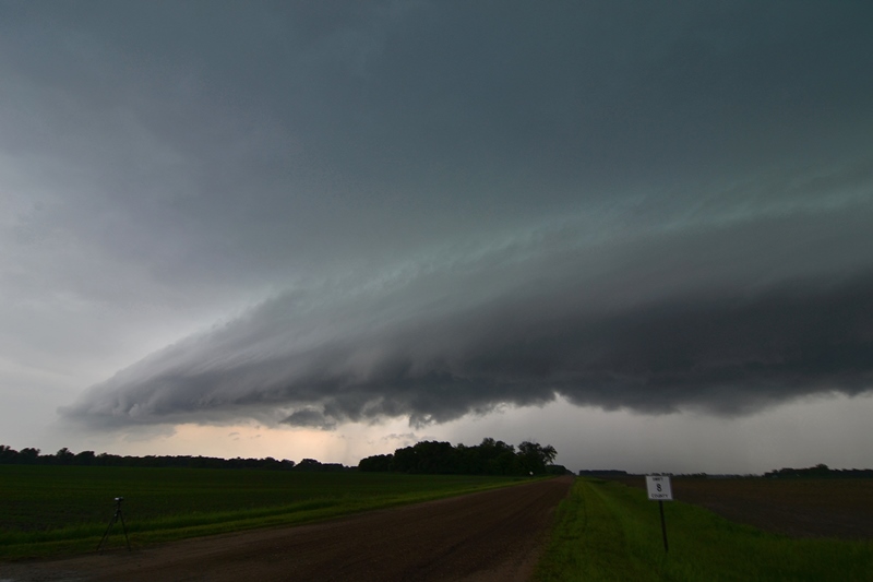
By this time there were additional cells blowing up around us, including a left moving supercell to the south across the Texas border that was tornado warned and heading towards us. While it looked like that cell was being interfered with by other cells, we wanted to get into a position to intercept it if we chose, and to do that we had to get south and east quickly in order to avoid the core of the storm we’d been watching as it was just about to cross the road. Unfortunately, it turned out our road option quickly became unpaved! It was called Rock Daisy Road, and while I didn’t see any daisies, it was basically made of rocks, and we were now 18 miles from pavement with big hail following right behind us! We were mostly able to stay out of the hail, but the road was horrible and I was worried about blowing a tire, not to mention that the dirt being kicked up by the other vehicles reduced visibility to near zero!
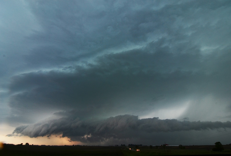
We eventually got well clear of the storm and parked the vans at an oil collection tank (this is really oil and gas country, with wells everywhere and the whole area for miles reeks of oil and signs that say “If you smell H2S, leave the area immediately!”, as if I knew what H2S smells like! We watched the storms from this vantage for a while but soon we had quarter sized hail dropping around us and it was time to get back in the vans and out to the pavement. We headed south on 285 towards Carlsbad then southwest on Rt. 137, stopping to watch the second storm behind the one we originally chased as it came towards us and intensified. Meanwhile, the tornado warned storm from the south was also clearly visible, having plowed through a bunch of smaller cells and survived. The structure of the storm to our west was fantastic! It had that spinning soda can look, and as the Sun set, was backlit nicely.

We watched that storm for another 30 minutes before the storms to the south began to interfere with it and it started to deteriorate, and with 3 hours to the hotel in Lubbock, it was time to go. As we stopped in Artesia to grab dinner before the long ride, we did get a nice mammatus display from the cluster of cells that the formerly tornado warned cells had become. We then drove to Lubbock with a nice lightning show going on around us, finally getting to the hotel around midnight.

Another good chase day! 518 miles for a tour total of 2138.

MAY 22ND TEXAS PANHANDLE: GUSTNADO, POSSIBLE LANDSPOUT


STORM REPORTS:

Storm Reports
Storm Reports

STORM PREDICTION CENTER OUTLOOKS:

SPC Outlooks
SPC Outlooks

MAY 22, 2014 CHASE LOG: TEXAS PANHANDLE

Written by Rich Hamel: (http://www.bostonstormchaser.com/)

  Mostly a re-positioning day with a little chasing mixed in, and maybe even a nice surprise at the end. We left Denver with the idea of chasing the north side of the Raton Mesa, but by the time we were down there the small mountain storms to the west had already messed up the atmosphere, so we continued south towards our stop for the night in Amarillo, TX. We stopped in Dalhart, TX briefly to assess the line of storms to our west, but they all looked like junk, so we continued south. As we got into Hartley and approached the line of storms, we diverted east on Rt. 87 towards Dumas to take a look at the flying dirt kicked up by the gust front ahead of the line. After a few minutes, the line caught us and produced a large, persistent gustnado off to our west. Taking a look later at contrast enhanced pictures, I think this may have actually been a landspout tornado. It was under an area marked as rotating (and with a TVS) on radar, has a tall columnar look at least half way to cloud base, was long lasting and did not get shoved out by the front flank downdraft like a gustnado would have been, and occurred right at the point of a cell merger in progress. The only thing missing was a definitive funnel at cloud base. Hmmmm….

After that we headed back to Hartley and south to check out a new cell coming north, but it was nothing more than a rainmaker and we continued on, going through cell after cell as we got into Amarillo, where there was significant flash flooding.

All in all, not a successful chase day… or was it?? Either way, it was 444 miles for the day, putting us at 1619 for the tour.

MAY 21ST COLORADO: TORNADO NEAR DIA AND SUPERCELL TIME LAPSE

 
DSC_0687
DSC_0687

Supercell over Denver that was dropping very large hail at the time over the city.

DSC_0689
DSC_0689

Closer view of the storm mesocyclone as it rolled off the foothills and right over Denver.

DSC_0691
DSC_0691

Another shot as the storm was moving closer.

DSC_0695
DSC_0695

Intense hail core in this storm as it moved over the eastern suburbs of Denver.  Caused a lot of damage with a noticeable hail swath even the next day.

DSC_0698
DSC_0698

Moving up towards our position a few miles south of Denver International Airport.

DSC_0703
DSC_0703

View of the entire storm, wall cloud, and the beginning of the tornado south of DIA.

May 21, 2014 CO Tornado2

Zoomed in view of the initial touchdown of the tornado south of DIA.

May 21, 2014 CO Tornado1

Appears the tornado grew larger upon becoming rain-wrapped but cannot be completely sure it was an intense core or tornado.

DSC_0712
DSC_0712

Silver Lining Tours enjoying the beauty of the storm.

DSC_0723
DSC_0723

Terrific mothership with possible rain-wrapped tornado in the core north of Watkins and near Front Range Airport.

DSC_0725
DSC_0725

Short while later with bowl lowering on the right side of the core.

DSC_0730
DSC_0730

Wanted to post this storm core photo because this is NOT a tornado.  Was reported as one and totally false.  Intense rain/hail core.

DSC_0734
DSC_0734

Another wall cloud forming on the storm north of Strasburg, CO.

DSC_0735
DSC_0735

A zoomed out view of the wall cloud and storm north of Strasburg, CO as the day was coming to an end.

STORM REPORTS:

140521_rpts_filtered

STORM PREDICTION CENTER OUTLOOKS:

SPC Outlooks
SPC Outlooks

MAY 21, 2014 CHASE LOG: COLORADO

Written by Rich Hamel: (http://www.bostonstormchaser.com/)

  Another great chase day, and for the most part we were within 40 miles of our hotel the whole time. After sleeping in at our hotel near Denver airport, we met late and headed out for lunch as storms were already bubbling up in the foothills of the Rockies. By the time we got the group back together, one of those storms was already severe just south of Denver, so we headed towards Bennett to get set up, initially targeting a cell off to the south. We quickly elected to change targets to the storm near Denver, hopping back on I-70 towards Denver. We soon were driving directly towards a big, low hanging wall cloud and the chase was on by 2 PM local time, only a few miles from our hotel! We got off the highway just south southeast of Denver International Airport and made our first stop as the storm was already showing significant rotation and had that greenish glow of a storm with large hail. We began stair stepping on the roads to the east of the airport and soon the storm was tornado warned and had now developed a long tail cloud out of the wall cloud area. We repositioned one more time and when we stopped and set up the storm was now showing violent rotation and quickly produced a brief elephant trunk tornado! The tornado quickly changed to a multi-vortex tornado then got swallowed by the massive precipitation core. From that point we were never able to clearly see it again, but now there were several reports of a tornado along Tower Road (where our hotel was!) so we knew it was in there. The precipitation core kept getting larger and larger as we continued stair stepping northeast in front of the big high-precipitation storm. We let the core get right up to us a couple of times then pulled away to get a better view of the structure, all the while weaving in and out of the hundreds of storm chasers who were on the storm. When we got to Rt. 36 east of Byers, we were in a full blown traffic jam, mostly precipitated by the Doppler on Wheels crews crawling along the road. At this point the storm had cycled down, but by about 5 PM it was cycling back up and was again tornado warned so we headed north on county roads northwest of Last Chance to get in front of the updraft again. This unfortunately proved impossible as multiple cells were opening up all around us, turning the roads to mud and making any chance of seeing anything impossible. We aborted our chase and had a wild, muddy ride east trying to get back to the pavement, finally succeeding north of Last Chance. As we got back on Rt. 36 heading back to Byers, the fields off to our north were covered with hail. After stopping at a restaurant for dinner we returned to the hotel, curious to see if there was any damage. It turns out they had gotten EIGHT INCHES of hail! It was 6 hours after the storm, and hail was still piled everywhere. The trees were absolutely shredded and there were numerous cars pock-marked by the dime and quarter sized hail. There were rabbits everywhere loving the “instant salad” created by the hail shredding the trees, and the neon sign at the diner we stopped at for breakfast was shattered. All in all, another fun chase day, and we didn’t have to drive 962 miles to do it! The miles do rack up though, and by the time we’d finished we’d done another 213 miles, for a total of 1175 for the first two days of the trip.

MAY 20TH COLORADO: WALL CLOUDS, LIBERTY BELL SUPERCELL, AND INCREDIBLE LIGHTNING DISPLAYED MOTHERSHIP SUPERCELL AT DARK

 
DSC_0551
DSC_0551

Wall cloud forming on the storm north of Byers, CO.

DSC_0573
DSC_0573

Wall cloud tightening up as it approaches.  Rain curtains being wrapped around the south side.

DSC_0598
DSC_0598

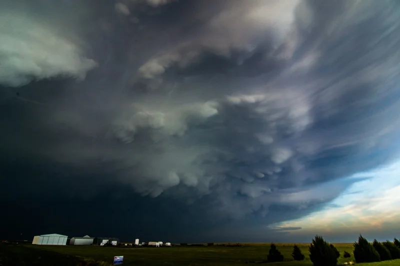
Supercell with bolt of lightning over wind farm northeast of Strasburg, CO.

DSC_0603
DSC_0603

Another shot of the supercell as it takes on a terrific mothership appearance.

DSC_0607
DSC_0607

Storm over windmill to the north of Limon, CO.

DSC_0613
DSC_0613

Beautiful mothership over the open landscape of eastern Colorado.  Great area to chase!

DSC_0616
DSC_0616

Great lighting for a photo opportunity near Flagler, CO.  Supercell has terrific spiraled structure at this time.

DSC_0619
DSC_0619

Awesome storm structure near Siebert, CO as the sun was starting to set to the west and allow for great back light.

DSC_0622
DSC_0622

Mammatus on the northeast side of the supercell near Siebert, CO.

DSC_0628
DSC_0628

Another shot of the supercell with the light of the setting sun shining through the rain curtains.

DSC_0630
DSC_0630

Could take photo after photo of this amazing storm.

DSC_0635
DSC_0635

The core opening up around the backside of the storm right at sunset.

DSC_0650
DSC_0650

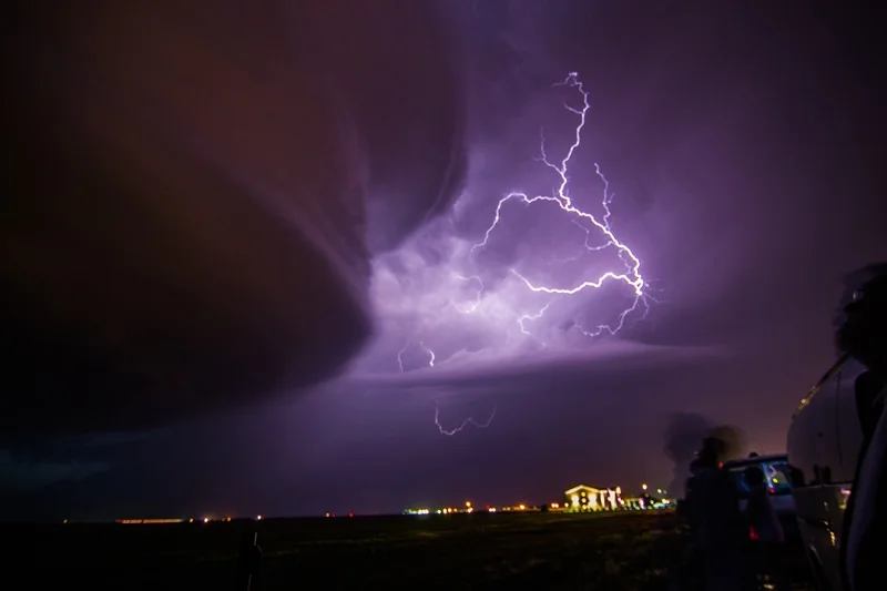
The lightning show was amazing near Burlington, CO during the evening.  See more photos below:

DSC_0654
DSC_0654
DSC_0660
DSC_0660

One of my favorite shots ever taken.  Might be framing this one I think!

DSC_0661
DSC_0661

Another great shot of the storm and lightning near Burlington, CO.  Was on a 6 second shutter speed.

DSC_0671
DSC_0671
DSC_0682
DSC_0682

Beautiful mothership moving overhead!!

DSC_0684
DSC_0684

Incredible storm moving into Burlington, CO.

STORM REPORTS:

140520_rpts_filtered

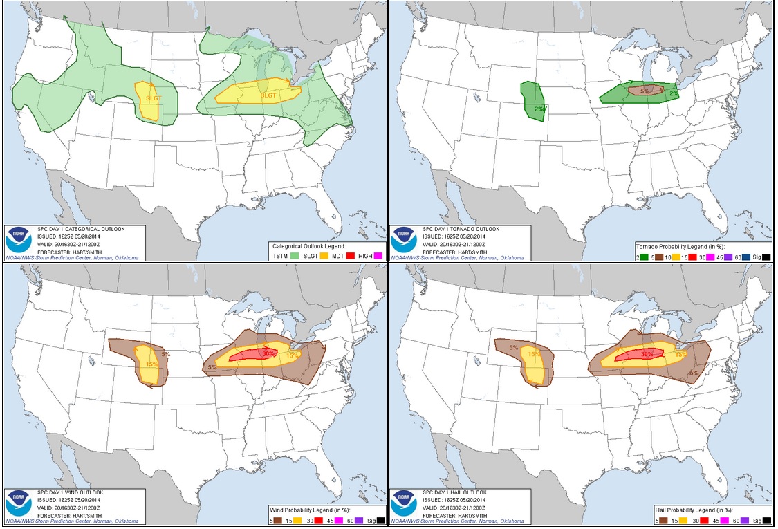
STORM PREDICTION CENTER OUTLOOKS:

SPC Outlooks
SPC Outlooks

MAY 20, 2014 CHASE LOG: COLORADO

Written by Rich Hamel: (http://www.bostonstormchaser.com/)

  An awesome chase day to start the tour! We left OKC early with the expectation of heading all the way up to Scott's Bluff, NE to play the frontal boundary on the Nebraska Panhandle. We stopped for lunch in Hays, KS and decided to continue to head west before deciding on our target as the HRRR model was now showing two distinct target areas: Nebraska as advertised, but now it also developed storms near Denver riding right along I-70 all the way into Kansas. We decided to continue to Burlington, CO before deciding, and once there chose the southern target as the models were now killing the activity up in Nebraska by 02-03Z but kept the Denver storms going all night. That, along with the fact that a Denver intercept was far easier, made the choice simple.

By the time we reached Limon for a quick pit stop, there was already a severe warned storm over Denver heading east-southeast right towards us. We set up in Byers as the storm approached from Bennett. As it got closer, it organized a broad, blocky wall cloud for a few moments, but it soon dissipated. Cold inflow was the rule of the day as it seemed to be streaming in from where we were at every stop, yet somehow it never appeared to choke off the storm. After the first wall cloud dissipated a second briefly formed, but as the storm neared our position and had large hail in it, we repositioned to Deer Trail for the second stop. Once there, we saw that the storm had become a huge HP hailer with a very broad base and a “nose down” wall cloud / tail cloud look. Soon the hail core encroached on us again and we drifted down to Agate. With the storm moving southeast now, we then had to bolt all the way to Limon to try and get north towards Last Chance and beat it to an east road.

As we headed north out of Limon and into the huge wind farm in that area we just had to stop and take some shots of the huge beast with the wind farm in the foreground. We stayed there for about 10 minutes, at which point our north road was cut off by a hail core sporting baseball sized stones, so we headed towards the interstate, but then decided to head east on County Road 3. We stayed just out ahead of the storm until finding great spot for a photo opportunity and stopped and observed again. With the storm to our northwest, there were definite signs of rotation developing and, then behind us to the southeast there was rapid motion and a “cinnamon swirl” vortex above us, spinning hard enough that we thought we might get a landspout. That eventually dissipated and we had to quickly run east and south as rain and hail began to fall in our location and we were worried about getting swamped on the dirt roads. We made one more stop north of Arriba to shoot the fantastically structured liberty bell updraft, then stopped at a rest area along the highway for a break, but you could see the “stack of plates” look just above us and the clouds curving into the storm above us, so we headed east again to stay in front of the storm.

We continued east to Vona and as the sun set were treated to the spectacular structure of the storm backlit by the orange sunset! The storm also had a nice array of mammatus clouds hanging off the front part of the anvil.

At that point it seemed like the storm was finally dying, but as the sun set, perhaps the low level jet kicked in because the storm re-intensified yet again into a tall soda can look. We made another stop in Bethune, then another in Burlington, and the structure at dusk just kept getting more and more amazing! By now the storm was highly electrified, but interestingly it was almost all cloud to cloud, with very few ground strokes. It was sort of eerie as the spinning updraft came almost right over us, then off to our southeast a huge bob of dirt flew up from the rear-flank downdraft, right around the time that they tornado warned the storm! It was obvious that the storm was way too high based to tornado though and we waited south of Burlington for the storm to zoom by, and then got back on the highway, retracing our steps 150 miles back to the hotel in Denver.

A day that greatly exceeded expectations! The HRRR model was dead on, as the Nebraska storms blew up, one went tornado warned, and then in about 2 hours they were gone, while the Denver storm raged right down I-70 into Kansas well into the evening as advertised.

962.6 miles for Day 1!

MAY 11TH NEBRASKA: EF3 AND EF2 TORNADOES, HP SUPERCELL, & LIGHTNING

 
Brad Tornado2_web
Brad Tornado2_web

Enhanced shot of the supercell with large EF3 tornado in progress, looking west off Hwy 15 towards Beaver Crossing, NE.

DSC_0501
DSC_0501

Another shot of the supercell with tornado underneath.  Can see left edge of the tornado fairly well in this shot.

DSC_0504
DSC_0504

Short while later as the tornado begins to become more rain-wrapped and storm really takes on high precipitation nature.

DSC_0510
DSC_0510

Different color scheme here as the tornado is now completely rain-wrapped.  Low, well defined inflow tail into the storm on right.

DSC_0527
DSC_0527

Storm getting closer as beaver tail (inflow tail) continues to scrape the ground.  This was north of I-80 near Seward.

DSC_0530
DSC_0530

Interesting features at this point near Malcolm, NE.  A couple areas of rotation on leading edge of RFD that appeared to be funnels.

DSC_0536
DSC_0536

Funnel cloud attempting to form here, moving left to right.  Also near Malcolm.

Raymond NE Tornado2
Raymond NE Tornado2

Video capture of the Raymond EF2 tornado, estimated at 300 yards wide.  Taken off Hwy 77 looking west.

DSC_0543
DSC_0543

Very low LCL's at this point when the storm was extremely hp.  Notice lowering near the center of the image in the background.  This was a new action area that formed on the storm east of Ceresco.

Lightning2
Lightning2

Video capture of lightning when a large amount of cg's were taking place as the storm was approaching west Omaha.

Lightning3
Lightning3

Another video capture of the awesome lightning display.

Lightning4
Lightning4

Yet another capture!

STORM REPORTS:

140511_rpts_filtered

STORM PREDICTION CENTER OUTLOOKS:

SPC Outlook
SPC Outlook
2014051120_metars_dsm

Surface observations at 3:43 PM CDT.  Notice backed surface winds into southeast Nebraska with dewpoints pooling in the upper 60s to 70F along and south of the warm front.  Terrific low level shear and ample moisture for supercells, while west-southwest to east-northeast orientation of the warm front was perfect for this storm to root and track along the boundary.

ESRH 20Z
ESRH 20Z

Enhanced Storm Relative Helicity per mesoanalysis at 3 PM CDT.  High sheared environment as storm develops near Hastings, NE.

ESTP 20Z
ESTP 20Z

Incredible Significant Tornado Parameter numbers in southeast Nebraska ahead of the developing tornadic supercell.  Also high along the front into Iowa but this area never fired with storms after the morning/early afternoon convection.

May 11, 2014 CHASE LOG: NEBRASKA

  I was rather undecided in regards to chasing on this day since I was leaving on a plane for work the next morning and knew that the best target area would be in eastern NE, making for a long haul back home and not much sleep.  However, after reviewing the setup and seeing a warm front draped across IA and within 3-4 hours from home, Wes Hyduke and I decided to make a trip down towards Des Moines to chase storms that we expected to fire on the warm front during the late afternoon.  We left Burnsville, MN at 11am.  The atmosphere had another plan though as the warm front never fired after the morning convection laid down an outflow boundary that appeared to wash out where the warm front actually was.  In addition, there may have been some subsidence and not enough time to destabilize behind the morning rain and storms as cloud cover stuck around just to the north of the remnant outflow boundary.  There was also ridging in the mid levels of the atmosphere behind this initial wave.  After dropping south to near Des Moines, we knew the play was going to be to blast west towards the NE target.  Most of the computer models, especially the HRRR, were blowing up a massive beast of a storm right on the intersection of the warm and cold front in the vicinity of Hastings, NE and moving this storm right along the warm front where it could continue to ingest the warm, humid, unstable air south of the boundary and low level shear maintenance.  This area was also under incredible Effective Storm Relative Helicity (ESRH) values of 400-600 m2/s2 and 2,000-3,000 j/kg of Mixed Layer CAPE with Bulk Shear values of 55-70 kts per mesoanalysis.  Surface and 850mb winds were also backed from the southeast ahead of the storm and along/south of the warm front making for very high low level wind shear and strongly curved hodographs.  Dewpoints were pooling in the upper 60s to near 70F in southeast NE where the storm would be ingesting its inflow air.

THE storm blew up on the boundary intersection near Hastings, NE between 19-20Z (2-3pm).  The SPC upgraded the percent chance for a tornado within 25 miles to 15% at the 20Z outlook along a narrow corridor that this storm would track in along the boundary (see outlook image).  Within an hour this storm was already producing tornadoes as we were still in western IA and approaching Omaha.  We continued on I-80 west to exit 379 and dropped south on Hwy 15 or 280th St.  After going south for 1.5 miles, we pulled off to watch an incredibly powerful supercell to our west.  At this point, it was producing a large tornado to the south of York, NE and near Beaver Crossing, NE.  I was not sure if we saw a tornado buried in the rain underneath this storm, but taking a look at the photos, it appears that the left edge of the tornado is shown before it became rain-wrapped upon approaching I-80.  This is at the same time the reports of a large tornado were showing up from other spotters and chasers closer to the storm.  As the storm neared, we followed north and back east on I-80 to exit 382 and then north on Hwy 238.  The storm at this point was really starting to become high precipitation (HP) and dangerous to stay ahead of at a close distance.  Upon getting on Hwy 34 and heading east, we stopped near Malcolm to take some photos and happened to notice the storm forming a wall cloud, which was hard to really get a glimpse of due to the hills and trees.  Our path took us north on Hwy 79 and after 4 miles the view opened up to the west where we witnessed a large tornado to our west.  This was near the small town of Raymond.  We moved east on W Raymond Rd and zig-zagged up Hwy 77 towards Ceresco where the storm continued to produce a large tornado, as seen by other chaser photos and videos at that time.  Even though there were still a few hours until sunset, it was pitch black at this time and street lights were on.  We continued east on some gravel roads towards the western outskirts of Omaha, having to turn around at one point due to coming up on a muddy road with water running over it.  This is where we were close to the storm and got into some strong winds, heavier rain, and small hail due to having to backtrack around these roads.  Thankfully we had given ourselves plenty of time to get ahead of the storm and were not in immediate danger of being hit by the rain-wrapped tornado.  Plus we did not want to get stuck on a muddy road in the middle of nowhere with a large tornado buried in the rain behind us!  Upon reaching Ashland, we had to cross the Platte River on Hwy 6 and then jumped on I-80 to get ahead of the storm, but staying southeast, as we got towards Omaha.  The storm started to gust out upon reaching Omaha after the fear that a large tornado would go through the city.  They still had some very strong, damaging winds go through the city as the storm gusted out and became outflow dominant with and embedded circulation.  The storm structure was amazing as we moved up I-80 through southwest Omaha!  We had a good view of the massive supercell mesocylone as we got further ahead from the storm.  The lightning was absolutely constant at this time.  We got ahead of the storm on I-29 north and then east on I-680.  The storm was starting to really bow out upon moving across the NE/IA border so we headed home to beat the storm close to sunset.  We made it back home to Burnsville by 12:30pm and I was on a plane by 9am the next morning, heading to South Carolina.  Certainly a long 48 hours with little sleep but definitely worth it!

MAY 8TH MINNESOTA: SUPERCELL THUNDERSTORM ON THE TRIPLE POINT

 
DSC_0472
DSC_0472

Thunderstorm developing north of the cell we were going after near Luverne, MN

DSC_0477
DSC_0477

Supercell on the triple point near Hills, MN.  Interesting lowering that had formed in the notch of the hook underneath the updraft.

DSC_0478
DSC_0478

Another view of the lowering a short while later.  Hook of the storm wrapping around with the RFD to the left of the image.

DSC_0483
DSC_0483

Sub-severe thunderstorm later in the day near St. James, MN

DSC_0487
DSC_0487

Another shot of the thunderstorm near St. James, MN.

DSC_0490
DSC_0490

Looking northeast from the same spot in St. James towards Mankato, MN where additional thunderstorms were ongoing.

DSC_0495
DSC_0495

Neat towering cumulus formed behind us at sunset as we drove up Hwy 60 towards Mankato, MN.

DSC_0497
DSC_0497

Another shot of the storm being back-lit by the sun, looking west from near Lake Crystal.

STORM REPORTS:

140508_rpts_filtered

STORM PREDICTION CENTER OUTLOOKS:

5-8 SPC Outlook
5-8 SPC Outlook

MAY 8, 2014 CHASE LOG: MINNESOTA

  This was a rather highly anticipated Moderate Risk day across MN and IA that was expected to produce tornadoes, but ended up only producing 2 in south-central MN.  The set-up included a small but vigorous 500 mb vorticity maximum moving quickly northeast into the Upper Midwest by late in the day.  The upper trough was positive tilt the entire time with the southern piece of the trough shearing off in the Southern Plains.  At the surface, a low pressure center was moving north-northeast through eastern NE towards far southwest MN, while a warm front became reinforced with early day convection across southern MN into northwest IA.  The triple point was located in far southwest MN to the southeast of Sioux Falls by late in the day, while the eastern portion of the warm front lifted faster to the north through southeast MN.

Our group consisting of me, Kyle Schanus and Joe Halverson left the Twin Cities around 9am and moved south and east to Fairmont, MN once again after being here the day before.  We waited around and were met by a few others, while watching the warm front slowly lift to the north towards our location.  Another round of elevated convection formed north of the warm front during the daytime hours and moved into eastern MN during the afternoon.  The atmosphere quickly destabilized to the west of this convection as some clearing took place, allowing MLCAPE to increase to near 1,500 j/kg, which was less than forecast.  Dewpoints climbed into the upper 60s with even a few 70F readings pooling just to the south of the warm front lifting up towards I-90 in central and southwest MN.  0-6km Bulk Shear increased to 40-70 kts across all of southern MN by late in the day, while impressive low level wind shear existed along the west-southwest to east-northeast oriented warm front.

My target area was on the triple point in southwest MN, but I knew we had to keep an eye on the St. James area along the warm front as the HRRR was breaking out a strong storm in this area.  Both areas would have good tornado potential, the problem was to pick which one.  We conferred and chose the triple point in southwest MN and quickly headed west on I-90 as a storm began to develop along the northeast NE/southeast SD border shortly before 2pm.  A mesoscale discussion was issued at 12:23pm for all of southern MN in anticipation of boundary layer supercell development in the next few hours (http://www.spc.noaa.gov/products/md/2014/md0524.html).  A tornado watch was then issued at 1:50pm for the area (http://www.spc.noaa.gov/products/watch/2014/ww0130.html).  As we eyed the storm approaching the southwest MN border, another storm went up back to our east towards Jackson.  We decided to continue on towards the storm on the triple point, instead of following the storm to our east, even though they were both in very good environments.  The eastern storm ended up producing 2 tornadoes, one near St. James and the other near Madelia.

We went west on I-90, then south on Hwy 6 to intercept the storm near Hills, MN; the farthest southwest town in the state.  We got on the storm near west of Hills off Cty Hwy 52 as it was producing a hook echo on radar.  The storm was in a great environment and right on the triple point with low LCL’s, so it had very good potential to produce.  In fact, two separate action areas formed, one on the nose of the hook and the other buried back in underneath the updraft.  Both areas had slow rotation and condensation taking place, specifically the area underneath the updraft.  There was a point that this storm was certainly going to produce a tornado as it was right on the warm front.  However, the storm did not right turn and ended up north of the warm front where it was in more stable air.  LCL’s were very low and wind shear was terrific north of the front, but it was just too stable to maintain the supercell intensity and it became a big hailer as we followed back north on Hwy 6 and then east on Hwy 8 to the north of Luverne.  Knowing this storm was done and it was the only thing in southwest MN, we had to bust back east towards the St. James storm, knowing full well we would probably not make it to the storm.  We did get on another storm, coincidentally near St. James towards evening, but it was nothing more than a sub-severe heavy thunderstorm.  We ended up calling it quits on the chase and headed back north on Hwy 169 back home.  However, another storm became tornado warned to the southwest of the Twin Cities and we intercepted this storm near Norwood Young America and followed it up Hwy 5 towards Victoria.  There were several weak notches and radar detected areas of rotation along the leading edge of this line, but no confirmed tornadoes.  The LCL’s were incredibly low with cloud bases seemingly on the ground and it was difficult to see being after sunset, even with quite a bit of lightning.  It was really eerie following this storm into a populated area at dark and we soon ended the chase and headed home.

MAY 7TH MINNESOTA: BACK-LIT THUNDERSTORMS AND VORTICITY ROLL

 
DSC_0411
DSC_0411

Rays of light shining through the developing thunderstorm over Fairmont, Minnesota.

DSC_0414
DSC_0414

Thunderstorm updraft starting to explode to the northeast of Fairmont, Minnesota.

DSC_0426
DSC_0426

Thunderstorm updrafts with anvil clouds overhead.  Taken off Hwy 53 north of Granada, Minnesota.

DSC_0429
DSC_0429

Think the plane contrail symbolizes the storms updraft quite well!

DSC_0433
DSC_0433

New updraft on the storm near Amboy, Minnesota.

DSC_0440
DSC_0440

Good color as we are getting towards sunset with this storm.  Small rain shaft underneath the cell.

DSC_0445
DSC_0445

Lucky enough to catch a bolt of lightning as I was taking photos of the storm at sunset!  Really like this shot.

DSC_0450
DSC_0450

Another shot of the sun setting underneath the base of the storm.  Awesome color!

DSC_0455
DSC_0455

Another storm updraft to our north close to the same time as the sunset photo taken above.  Notice the inflow tails into the storm.  Still high-based north of the warm front.

DSC_0468
DSC_0468

One last shot of the storm at sunset before we headed home.

Vorticity Roll
Vorticity Roll

Video grab of the vorticity roll as we were driving under the storm in the vicinity of Mapleton.

Vorticity Roll1
Vorticity Roll1

Another shot of the incredible vorticity roll, or horizontal rotating column of air embedded in the storm's base.

STORM REPORTS:

140507_rpts_filtered

STORM PREDICTION CENTER OUTLOOKS:

050714 SPC Outlooks
050714 SPC Outlooks

MAY 7, 2014 CHASE LOG: MINNESOTA

  This chase was along a warm front through southern MN, while a surface low entered southwest portions of the state during the afternoon.  Even though the upper trough was still well to the west and across the Rockies with some ridging in the Upper Midwest, there was ample wind shear and instability for supercell thunderstorms if updrafts could overtake the strong EML/cap.  Bulk shear by late in the day was increasing to 40-50 kts with the 2,500 j/kg MLCAPE contour poking up into south-central MN per mesoanalysis.  It appeared that most of the storms would remain elevated in nature to the north of the warm front and storm motion would be slow to the northeast, but any storm that would be able to root on the warm front would have the chance at producing a tornado, especially considering the high SRH values along and north of the front.

Our group consisted of me, Joe Halverson, and Kyle Schanus.  We progressed towards Fairmont, MN during the afternoon.  The area was ahead of the triple point to the west and along the warm front lifting up towards the I-90 corridor.  At 2:28pm, SPC issued a mesoscale discussion regarding the potential for at least marginally severe hail with any vigorous storms that can develop (http://www.spc.noaa.gov/products/md/2014/md0513.html).  Thunderstorms began to develop ahead of the surface low around 5pm right in the vicinity of Fairmont and then become severe shortly after 6pm.  A severe thunderstorm watch was then issued at 6:45pm for southern MN along the warm front (http://www.spc.noaa.gov/products/watch/2014/ww0126.html).  We watched the cumulus towers go up from the McDonald’s parking lot in Fairmont and then followed the storms east on I-90 and then north on Hwy 53 near Granada.  We followed the storms northeast through Mapleton and then ended the chase shortly after sunset.

There was not a ton of excitement on this chase, but we did manage to see some photogenic storms (especially towards sunset), drive through some dime sized hail, and even see a vorticity roll just after sunset!  See the video and screen capture to view this horizontal, rotating column of air.  It was a neat and rare sight to see!

April 23rd TEXAS - SUPERCELL STORM OFF THE DRYLINE

 
IMG_1523
IMG_1523

My location in the crosshairs as I was playing catch up to the impressive looking storm on radar.  Even had an indication of a hook developing!

IMG_3082-2
IMG_3082-2

View of the supercell that I was going after on the right, and another storm that had developed to the north (on the left).

IMG_3093-2
IMG_3093-2

Getting closer to the storm east of Garden City, TX.  Can notice a flanking line attempting to get going on the southwest side of the storm as I'm looking to the northeast.

IMG_3097-2
IMG_3097-2

Another view of the storm as I approached, upon heading north out of Sterling City, TX.  Fairly large rain and hail core.

IMG_3099-2
IMG_3099-2

RFD clear slot cutting in on the left side of the image with some noticeable  motion occurring at this time, where the clear slot intersected the storm's high base.

IMG_3103-2
IMG_3103-2

Flanking line bases of new storm updrafts developing to the southwest of the storm I'm following near Sterling City, TX.

IMG_3117-2
IMG_3117-2

Setting sun behind the storm with dark bases of new storm updrafts overhead.

IMG_1527-2
IMG_1527-2

Nice circular, bowl base on the storm as I caught up to it northeast of Sterling City, TX.

IMG_1532-2
IMG_1532-2

This might be one of the smallest hail shafts that I've ever seen!  A small but intense tube of hail being ejected out of the south side of the storm's updraft.

IMG_3125
IMG_3125

Beautiful mesa rock formation in the distance being lit up by the setting sun.  South of Silver, TX.

STORM REPORTS:

140423_rpts_filtered

STORM PREDICTION CENTER OUTLOOKS:

day1otlk_20140423_1630_prt
day1probotlk_20140423_1630_hail_prt
day1probotlk_20140423_1630_torn_prt
day1probotlk_20140423_1630_wind_prt

APRIL 23, 2014 CHASE LOG: TEXAS

  This was a spur of the moment chase after working in Midland, TX at the Web.com Tour as the on-site Meteorologist.  I knew that storms would be firing on the dryline later in the day, about 30 miles east of Midland Country Club.  I was able to leave work at 6pm and drive southeast from Midland on Hwy 158 through Garden City over to Sterling City.  There was one storm that was holding together nicely that I was targeting.  Even though the LCL’s were very high with dewpoints in the middle 50s and weak bulk shear, there was enough SB  CAPE of near 2,000 j/kg to sustain a lower topped supercell storm that developed off the dryline and was only moving 15 mph to the east-northeast.  Upon approaching the storm, it began to form a hook echo signature as the RFD was attempting to wrap around.  No chance of a tornado though since it was so high based, but I was hoping to possibly see a funnel.  I was able to catch up to this storm near Sterling City, taking Hwy 158 to the north and then east.  At this point, it became severe warned right as the storm started to form a nice, cylindrical base.  The hail core was clearly strengthening at this time, hence the reasoning for the severe warning per the NWS.  It really had nice structure for a while before flanking line storms started to take over and rob the initial storm.  Towards sunset, I followed north on a remote Hwy 2059 towards the town of Silver.  Here is where I drove into a small hail core of dime size.  This was one of the smallest hail chutes that I had ever seen, being thrown out the south side of the storm.  Glad the hail was not large enough to damage my rental car!  Upon reaching Silver, it was dark and I proceeded north to I-20 and back to Midland.  A fun little chase after a day of work.